geo.wikisort.org - River
Virvasselva or Virvassåga (Norwegian) or Viresjåhkå (Lule Sami) is a river in the municipality of Rana in Nordland county, Norway. The river flows out of the eastern part of the lake Virvatnet. The stream Boneselva meets Virvasselva about 1 kilometre (0.62 mi) east of the lake Virvatnet. This is a large, continuous, very rich and untouched wetland area with tarns, rivers, marshes, and very tight vegetation. Virvasselva has a good population of Arctic char.
| Virvasselva / Virvassåga | |
|---|---|
 | |
 Location of the river  Virvasselva (Norway) | |
| Native name | Viresjåhkå (Lule Sami) |
| Location | |
| Country | Norway |
| County | Nordland |
| Municipalities | Rana Municipality |
| Physical characteristics | |
| Source | Virvatnet |
| • location | Rana, Norway |
| • coordinates | 66°18′36″N 15°24′12″E |
| • elevation | 645 metres (2,116 ft) |
| Mouth | Ranelva |
• location | Rana, Norway |
• coordinates | 66°26′48″N 15°07′54″E |
• elevation | 319 metres (1,047 ft) |
| Length | 21 km (13 mi) |
| Basin features | |
| Progression | Ranelva |
After about 5 kilometres (3.1 mi), the river Virvasselva reaches a pumping station where most of the water is diverted through a tunnel to flow west to supply the Rana power station. The much smaller river then continues north and meets the main river Ranelva at Elvmøtheia in the Dunderland Valley.[1]
Media gallery
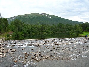 The lowest part of Virvasselva
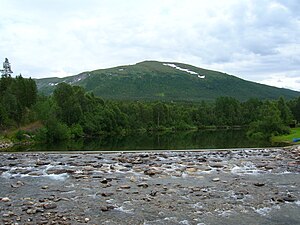 The lowest part of Virvasselva
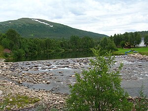 The lowest part of Virvasselva
 Virvasselvas meeting with Ranelva (on the right)


See also
- List of rivers in Norway
References
- Store norske leksikon. "Rana kraftstasjon" (in Norwegian). Retrieved 2011-12-19.
This Nordland location article is a stub. You can help Wikipedia by expanding it. |
This article related to a river in Norway is a stub. You can help Wikipedia by expanding it. |
Другой контент может иметь иную лицензию. Перед использованием материалов сайта WikiSort.org внимательно изучите правила лицензирования конкретных элементов наполнения сайта.
WikiSort.org - проект по пересортировке и дополнению контента Википедии