geo.wikisort.org - River
The Uhabia or Ouhabia is a coastal river of the French Basque Country, in Aquitaine, southwest France. It is 15.1 km (9.4 mi) long.[1]
| Uhabia | |
|---|---|
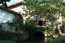
 The Uhabia in Bidart | |
| Location | |
| Country | France |
| Physical characteristics | |
| Source | |
| • location | Woods of Ustaritz |
| Mouth | |
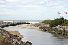
• location | Bay of Biscay |
• coordinates | 43°25′56″N 1°35′59″W |
| Length | 15 km (9 mi) |
Geography


It rises at Goizbide in the woods above Ustaritz and Saint-Pée-sur-Nivelle, where it is known as the Apalagako erreka. It collects waters from the Alhorgako Erreka and drains the plain of Belhardi in the north of Ahetze, before flowing into the Bay of Biscay in Bidart.
Name
Its name Uhabia is the regular evolution of ur habia, that can be translated as "course of the water".
Main tributaries
- Barrandiko Erreka, from Othe Xuria
- Alhorgako Erreka, from Zirikolatz
Départements and towns
References
| Wikimedia Commons has media related to Uhabia. |
На других языках
[de] Uhabia
Der Uhabia (auch Ouhabia genannt) ist ein kleiner Küstenfluss im französischen Baskenland, welcher im Département Pyrénées-Atlantiques in der Region Nouvelle-Aquitaine verläuft.- [en] Uhabia
Текст в блоке "Читать" взят с сайта "Википедия" и доступен по лицензии Creative Commons Attribution-ShareAlike; в отдельных случаях могут действовать дополнительные условия.
Другой контент может иметь иную лицензию. Перед использованием материалов сайта WikiSort.org внимательно изучите правила лицензирования конкретных элементов наполнения сайта.
Другой контент может иметь иную лицензию. Перед использованием материалов сайта WikiSort.org внимательно изучите правила лицензирования конкретных элементов наполнения сайта.
2019-2025
WikiSort.org - проект по пересортировке и дополнению контента Википедии
WikiSort.org - проект по пересортировке и дополнению контента Википедии

