geo.wikisort.org - River
Tverråga is a river in the municipality of Rana in Nordland county, Norway. The river flows from lake Tverrvatnet north until it joins the river Ranelva. The river absorbs seven other rivers during its course, the last one by Hamaren near the village of Gruben.
| Tverråga | |
|---|---|
 Tverråga seen from the road to Hammeren | |
 Location of the river  Tverråga (Norway) | |
| Location | |
| Country | Norway |
| County | Nordland |
| Municipalities | Rana Municipality |
| Physical characteristics | |
| Source | Tverrvatnet |
| • location | Rana, Norway |
| • coordinates | 66.25424°N 14.54326°E |
| • elevation | 501 metres (1,644 ft) |
| Mouth | Ranelva |
• location | Mo i Rana, Norway |
• coordinates | 66.32169°N 14.17841°E |
• elevation | 10 metres (33 ft) |
| Length | 30 km (19 mi) |
| Basin size | 196 km2 (76 sq mi) |
| Basin features | |
| River system | Ranelva |
The Svenskvegen bridge connecting the European route E6 highway to the village of Gruben to the east marks a name change on the bridge. South of the bridge this river is the Tverråga, but the remaining section of the river to the north of the bridge is called the river Revelelva. The 800-metre (2,600 ft) long Revelelva then flows into the river Ranelva.[1]
Media gallery
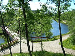 Tverråga seen from Klokkerhagen
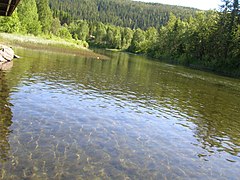 Tverråga seen from Klokkerhagen
 Tverråga seen from Klokkerhagen
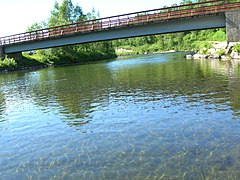 Tverråga seen from Klokkerhagen
 Tverråga seen from Klokkerhagen
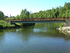 Tverråga seen from Klokkerhagen
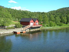 Tverråga seen from Klokkerhagen
 Tverråga (bridge before Klokkerhagen)
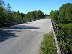 Bridge before Klokkerhagen
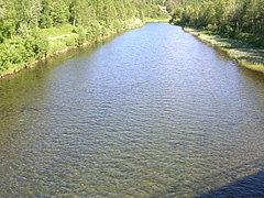 Tverråga (bridge before Klokkerhagen)
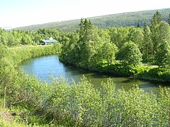 Tverråga seen from the road to Hammeren
 Tverråga seen from Svenskveien between E6 and Gruben


See also
- List of rivers in Norway
References
- Store norske leksikon. "Tverråga" (in Norwegian). Retrieved 2011-12-19.
This Nordland location article is a stub. You can help Wikipedia by expanding it. |
This article related to a river in Norway is a stub. You can help Wikipedia by expanding it. |
Другой контент может иметь иную лицензию. Перед использованием материалов сайта WikiSort.org внимательно изучите правила лицензирования конкретных элементов наполнения сайта.
WikiSort.org - проект по пересортировке и дополнению контента Википедии