geo.wikisort.org - River
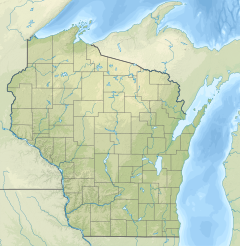
The Trimbelle River is a 29.4-mile-long (47.3 km)[1] tributary of the Mississippi River in western Wisconsin in the United States.[2] It flows for its entire length in western Pierce County, rising in the town of Martell and flowing generally southwardly through the towns of River Falls, Trimbelle, Trenton and Diamond Bluff. It flows into the Mississippi River about 5 miles (8 km) west of Bay City.
| Trimbelle River | |
|---|---|
 Trimbelle River at Trimbelle | |
 Mouth of the Trimbelle River | |
| Location | |
| Country | United States |
| State | Wisconsin |
| County | Pierce County, St. Croix County |
| Physical characteristics | |
| Source | |
| • location | Martell, Wisconsin |
| • coordinates | 44.866078°N 92.4674141°W |
| Mouth | |
• location | west of Bay City, Wisconsin |
• coordinates | 44°36′14″N 92°34′03″W |
| Length | 29.4 mi-long (47.3 km) |
| Basin features | |
| River system | Mississippi River |
The Trembelle has been designated by the state of Wisconsin as a Class II trout stream for brown trout. Several sections of the Trimbelle have been restored by the local chapter (KIAPTUWISH) of Trout Unlimited.[3]
See also
References
- U.S. Geological Survey. National Hydrography Dataset high-resolution flowline data. The National Map, accessed October 5, 2012
- U.S. Geological Survey Geographic Names Information System: Trimbelle River
- "Trimbelle River". KIAPTUWISH Chapter of Trout Unlimited. Retrieved April 10, 2021.
This article about a location in Pierce County, Wisconsin is a stub. You can help Wikipedia by expanding it. |
Текст в блоке "Читать" взят с сайта "Википедия" и доступен по лицензии Creative Commons Attribution-ShareAlike; в отдельных случаях могут действовать дополнительные условия.
Другой контент может иметь иную лицензию. Перед использованием материалов сайта WikiSort.org внимательно изучите правила лицензирования конкретных элементов наполнения сайта.
Другой контент может иметь иную лицензию. Перед использованием материалов сайта WikiSort.org внимательно изучите правила лицензирования конкретных элементов наполнения сайта.
2019-2026
WikiSort.org - проект по пересортировке и дополнению контента Википедии
WikiSort.org - проект по пересортировке и дополнению контента Википедии