geo.wikisort.org - River
The Tefé River (Teffé River in early accounts; Portuguese: Rio Tefé) is a tributary of the Amazon River (Solimões section) in Amazonas state in north-western Brazil.
| Tefé River | |
|---|---|
 | |
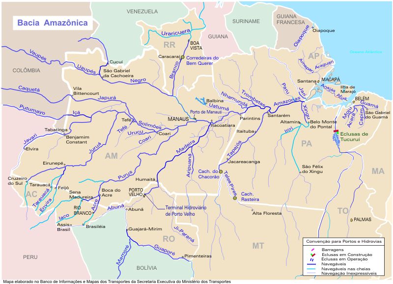 Tefé River center-left (west of Manaus) | |
| Location | |
| Country | Brazil |
| State | Amazonas |
| Physical characteristics | |
| Source | |
| • location | 5°26'05.5"S 66°55'44.5"W |
| Length | 450 km (280 mi)[1] |
| Discharge | |
| • average | 811 m3/s (28,600 cu ft/s) |
The Tefé River flows through the Juruá-Purus moist forests ecoregion.[2] It forms the eastern boundary of the Tefé National Forest, created in 1989.[3] Immediately before merging into the Amazon, it forms Lake Tefé (Portuguese: Lago Tefé). The city of Tefé is located on the banks of the lake. The Tefé River is a blackwater river.
See also
References
- Ziesler, R.; Ardizzone, G.D. (1979). "Amazon River System". The Inland waters of Latin America. Food and Agriculture Organization of the United Nations. ISBN 92-5-000780-9. Archived from the original on 8 November 2014.
- Sears, Robin, South America: Amazon Basin, northwestern Brazil (NT0133), WWF: World Wildlife Fund, retrieved 2017-03-28
- FLONA de Tefé (in Portuguese), ISA: Instituto Socioambiental, retrieved 2016-10-19
На других языках
- [en] Tefé River
[ru] Тефе (река)
Тефе́ (порт. Rio Tefé) — река в Бразилии, правый приток Амазонки. Длина 450 км[1].Текст в блоке "Читать" взят с сайта "Википедия" и доступен по лицензии Creative Commons Attribution-ShareAlike; в отдельных случаях могут действовать дополнительные условия.
Другой контент может иметь иную лицензию. Перед использованием материалов сайта WikiSort.org внимательно изучите правила лицензирования конкретных элементов наполнения сайта.
Другой контент может иметь иную лицензию. Перед использованием материалов сайта WikiSort.org внимательно изучите правила лицензирования конкретных элементов наполнения сайта.
2019-2026
WikiSort.org - проект по пересортировке и дополнению контента Википедии
WikiSort.org - проект по пересортировке и дополнению контента Википедии