geo.wikisort.org - River
The Tambre is a coastal river that crosses Galicia, in northwestern Spain. Its basin covers 1,531 square kilometres (591 sq mi).
| Tambre | |
|---|---|
 River Tambre | |
 Tambre river basin (dark blue) | |
| Native name | Río Tambre (Spanish) |
| Location | |
| Country | Spain |
| State | Galicia (Spain) |
| Physical characteristics | |
| Source | Montes de Bocelo |
| • location | Sobrado, A Coruña |
| Length | 134 km (83 mi) |
| Basin size | 1,531 km2 (591 sq mi) |
| Discharge | |
| • location | Ponte Nafonso |
| • average | 54.1[1] m3/s (1,910 cu ft/s) |
| • maximum | 1,160 m3/s (41,000 cu ft/s)12 December 1989 |
| Basin features | |
| Tributaries | |
| • left | Mera, Sionlla |
| • right | Maruzo, Samo, Lengüelle, Dubra, Barcala |
The river flows through the province of A Coruña; the municipalities along its course are Sobrado, Curtis, Vilasantar, Boimorto, Mesía, Frades, Arzúa, O Pino, Oroso, Ordes, Trazo, Tordoia, Santiago de Compostela, Val do Dubra, Ames, A Baña, Brion, Negreira, Outes, Mazaricos, Noia and Lousame. Its mouth forms the Ría de Muros e Noia estuary.
It has been designated a Site of Community Importance.
In ancient times it was called Támaris, its name being related to that of the River Tamar in Cornwall. It was from the lands north of this river that the Spanish County of Trastámara and the royal House of Trastámara derive their name (Tras-Támara meaning "across the Tambre"). Tamarix may derived its name from the river.
Gallery
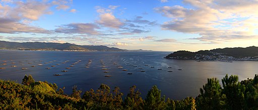 Ría de Muros e Noia
 Ponte Maceira bridge
 Ponte Nafonso bridge


See also
References
- Río Barja, Francisco Javier; Rodríguez Lestegas, Francisco (1992). Os rios galegos : morfoloxia e rexime. Santiago de Compostela: Consello da cultura galega. p. 150. ISBN 8487172768.
На других языках
- [en] Tambre (river)
[it] Tambre (fiume)
Il Tambre è un fiume spagnolo che scorre interamente nella Provincia della Coruña in Galizia. Esso scorre per 134 km, dalle sorgenti di Montes de Bocelo alla baia di Ría de Muros y Noya, ove si getta nell'Oceano Atlantico.[ru] Тамбре (река)
Та́мбре[1][2][3][4] (исп. Río Tambre) — река в испанском регионе Галисия. Берёт начало в муниципалитете Собрадо. Течёт по территории провинции Ла-Корунья. Принимает правые притоки Само[d] и Ленгелье[d], впадает в бухту Мурос-и-Ноя[es] Атлантического океана[1], у города Ноя[2][3].Другой контент может иметь иную лицензию. Перед использованием материалов сайта WikiSort.org внимательно изучите правила лицензирования конкретных элементов наполнения сайта.
WikiSort.org - проект по пересортировке и дополнению контента Википедии