geo.wikisort.org - River
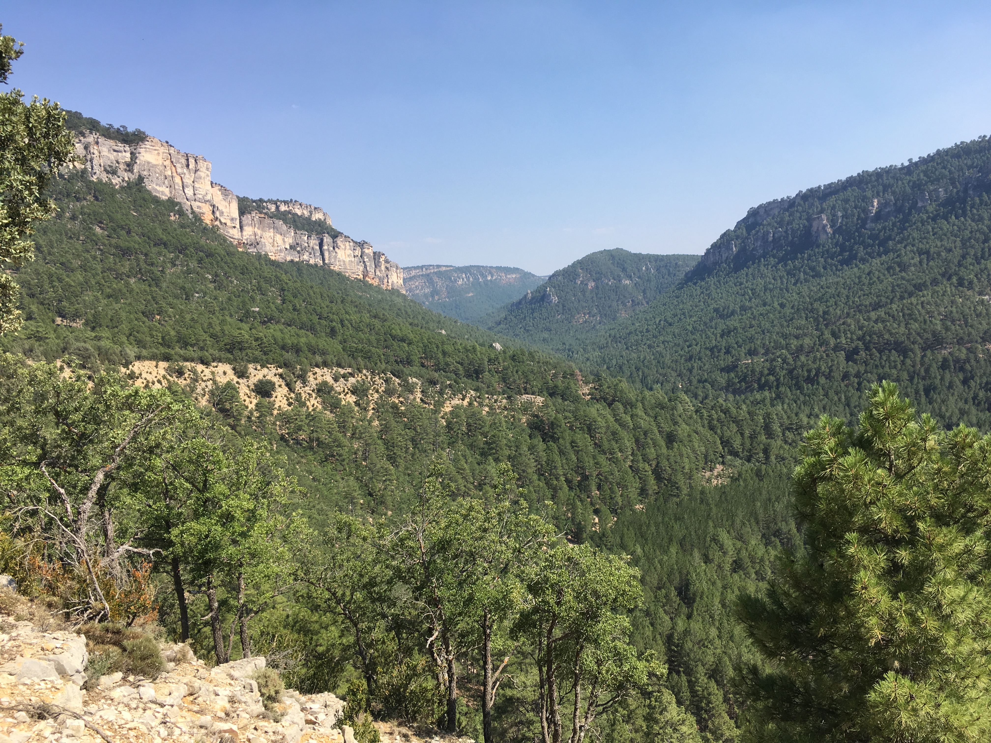
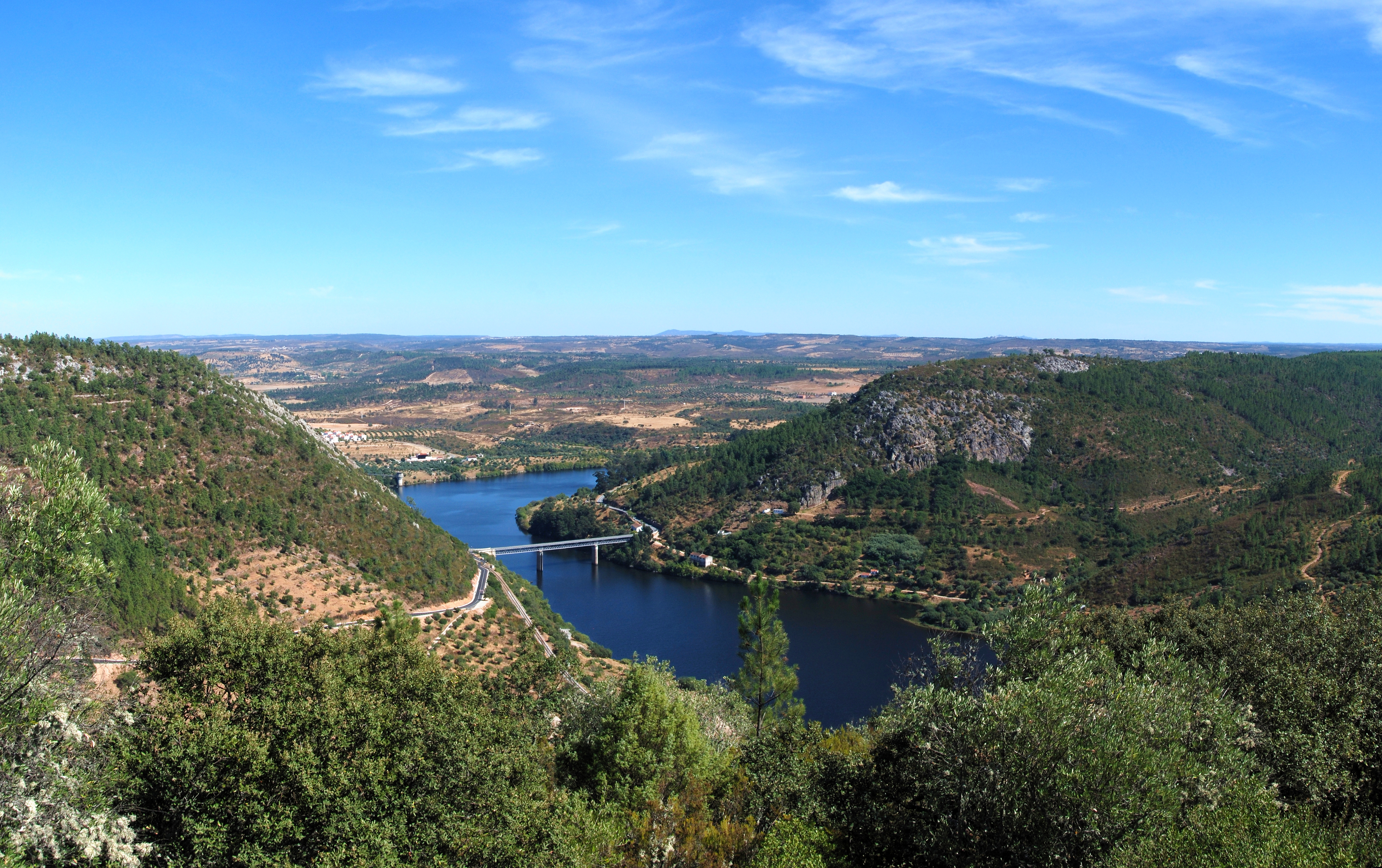
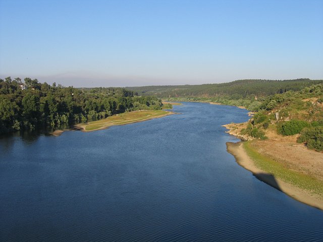
The Tagus (/ˈteɪɡəs/ TAY-gəs; Spanish: Tajo [ˈtaxo]; Portuguese: Tejo [ˈtɛʒu]; see below) is the longest river in the Iberian Peninsula. The river rises in the Montes Universales near Teruel, in mid-eastern Spain, flows 1,007 km (626 mi), generally west with two main south-westward sections, to empty into the Atlantic Ocean in Lisbon. Its drainage basin covers 80,100 km2 (30,927 sq mi) – exceeded in the peninsula only by the Douro. The river is highly used. Several dams and diversions supply drinking water to key population centres of central Spain and Portugal; dozens of hydroelectric stations create power. Between dams it follows a very constricted course, but after Almourol, Portugal it has a wide alluvial valley, prone to flooding. Its mouth is a large estuary culminating at the major port, and Portuguese capital, Lisbon.
This article may be expanded with text translated from the corresponding article in Spanish. (April 2009) Click [show] for important translation instructions.
|
This article needs additional citations for verification. (January 2010) |
| Tagus | |
|---|---|
 View of Tagus River in Toledo, Spain | |
 Path of the Tagus through the Iberian Peninsula | |
| Etymology | Vulgar Latin taliāre, "to cut through" |
| Location | |
| Country | Spain, Portugal |
| Physical characteristics | |
| Source | Fuente de García |
| • location | Montes Universales, Sierra de Albarracín Comarca, Teruel, Aragon, Spain |
| • elevation | 1,593 m (5,226 ft) |
| Mouth | Estuary of the Tagus |
• location | Atlantic Ocean near Lisbon, Portugal |
• elevation | 0 m (0 ft) |
| Length | 1,007 km (626 mi) |
| Basin size | 80,100 km2 (30,900 sq mi) |
| Discharge | |
| • average | 500 m3/s (18,000 cu ft/s) |
| Basin features | |
| Tributaries | |
| • left | Guadiela, Algodor, Gévalo, Ibor, Almonte, Salor, Sever |
| • right | Gallo, Jarama, Guadarrama, Alberche, Tiétar, Alagón, Zêzere |
The source is specifically: in political geography, at the Fuente de García in the Frías de Albarracín municipality; in physical geography, within the notably high range, the Sistema Ibérico (Iberian System), of the Sierra de Albarracín Comarca. All the major tributaries are right bank, which is locally to the north. The river flows 716 km (445 mi) in Spain, 47 km (29 mi) along the two countries' border and 275 km (171 mi) in Portugal.
The main cities the rivers passes through consecutively are Aranjuez, Toledo and Talavera de la Reina in Spain, and Abrantes, Santarém, Almada and Lisbon in Portugal. The Spanish capital, Madrid, lies in the upper drainage basin.
Course
This section does not cite any sources. (October 2022) |

In Spain

The first notable city on the Tagus is Sacedón. Below Aranjuez it receives the combined flow of the Jarama, Henares, Algodor and Tajuña. Below Toledo it receives the Guadarrama River. Above Talavera de la Reina it receives the Alberche. At Valdeverdeja is the upper end of the long upper reservoir, the Embalse de Valdecañas, beyond which are the Embalse de Torrejon, into which flow the Tiétar, and the lower reservoir, the Alcántara Dam into which flows the Alagón at the lower end.
A canal and aqueduct are between the Tagus and the Segura for the Tagus-Segura Water Transfer.

In Portugal
After forming the border it enters Portugal, passing Vila Velha de Ródão, Abrantes, Constância, Entroncamento, Santarém and Vila Franca de Xira at the head of the long narrow estuary, which has Lisbon at its mouth. The estuary is protected by the Tagus Estuary Natural Reserve. Two bridges span the river at Lisbon: the Vasco da Gama Bridge – the second longest bridge in Europe, with a total length of 17.2 km (10.7 mi) – and the 25 de Abril Bridge. The Port of Lisbon, straddling its mouth, is one of Europe's busiest.
The Portuguese Alentejo region and the former Ribatejo Province take their names from the river: Alentejo, from além Tejo ("beyond the Tejo") and Ribatejo probably from arriba Tejo (an archaic phrase for "upper Tejo"). However, the Spanish word riba means "riverside", or "riviera", implying that Ribatejo can also mean very generically "the side of Tejo". Many instances of towns in Spain have this prefix.
Name
The river's Latin name is Tagus. While the etymology is unclear, the most probable etymological origin for the hydronym Tagus is Indo-European *(s)tag- ('to drip').[1] It is known under different names in the languages of Iberia: Basque: Tajo, Catalan: Tajo, Galician: Río Texo, Mirandese: Riu Teijo, Portuguese: Tejo, Spanish: Tajo. It is known in Italian as Tago and Greek as Τάγος (Tágos).
Geology
The lower Tagus is on a fault line. Slippage along it has caused numerous earthquakes, the major ones being those of 1309, 1531 and 1755.[2]
History
The Pepper Wreck, properly the wreck of the Nossa Senhora dos Mártires, is a shipwreck located and excavated at the mouth of the Tagus between 1996 and 2001.
The river had strategic value to the Spanish and Portuguese empires, as it guarded the approach to Lisbon.[citation needed]
In 1909, the region experienced a strong and damaging earthquake.[3]
In popular culture
A major river, the Tagus is brought to mind in the songs and stories of the Portuguese. A popular fado song in Lisbon notes that, while people get older, the Tagus remains young (“My hair getting white, the Tagus is always young”). The author, Fernando Pessoa, wrote a poem[4] that begins:
The Tagus is more beautiful than the river that flows through my village.
But the Tagus is not more beautiful than the river that flows through my village...
Richard Crashaw (died 1649) wrote a poem "Saint Mary Magdalene, or the Weeper". This refers to the "Golden" Tagus as wanting Mary Magdalene's silver tears. In classical poetry, the Tagus was famous for its gold-bearing sands (the catalogued works of: Catullus 29.19; Ovid's Amores 1.15.34; Juvenal's Satires 3.55; and others).
See also
- Tagus Basin
- List of rivers of Spain
- List of rivers of Portugal
References
- Curchin, Leonard A. (2007). "Toponyms of Lusitania: a re-assessment of their origins" (PDF). Conímbriga. XLVI: 151. doi:10.14195/1647-8657_46_7.
- Hobbs, William Herbert (1907). Earthquakes: An Introduction to Seismic Geology. New York: D. Appleton and Company. pp. 142–144. Downloadable Internet Archive
- "Sismo sentido em Lisboa na mesma zona dos grandes abalos de 1531 e 1909" [Earthquake felt in Lisbon in the same area as the great earthquakes of 1531 and 1909] (in Portuguese). Diário de Notícias. 18 March 2021. Retrieved 29 October 2021.
- Pessoa, Fernando (1999). Fernando Pessoa and Co.: Selected Poems. Translated by Zenith, Richard. Grove Press. p. 55. ISBN 9780802136275.
| Authority control: National libraries |
|---|
На других языках
[de] Tajo
Der Tajo (span.) bzw. Tejo (port.; antiker Name Tagus) fließt in Ost-West-Richtung durch Spanien und Portugal und ist mit ca. 1007 km der längste Fluss auf der Iberischen Halbinsel.- [en] Tagus
[it] Tago
Il Tago (Tajo in spagnolo e Tejo in portoghese) è il fiume più lungo della Penisola iberica, che attraversa con un corso di circa 1008 km; di cui 716 percorsi in Spagna e 292 in Portogallo.[ru] Тахо (река)
Та́хо[1] (исп. Tajo), или Те́жу[2] (порт. Tejo, лат. Tagus) — крупнейшая река Пиренейского полуострова.Другой контент может иметь иную лицензию. Перед использованием материалов сайта WikiSort.org внимательно изучите правила лицензирования конкретных элементов наполнения сайта.
WikiSort.org - проект по пересортировке и дополнению контента Википедии