geo.wikisort.org - River
The Surna is a river in Trøndelag and Møre og Romsdal counties in Norway. It runs from Rindal Municipality (in Trøndelag) to Surnadal Municipality (in Møre og Romsdal). The 45-kilometre (28 mi) long river begins near Øvre Rindal at the confluence of the rivers Tiåa and Lomunda. The river then flows west and empties into the Surnadalsfjorden at the village of Surnadalsøra. Several smaller rivers flow into the Surna from the Trollheimen mountains to the south. The Foldsjøen and Gråsjøen reservoirs along the Folda River also flow into the Surna. The river is a good fishing river.[1] The Brandåa, Gryta, and Kysinga hydroelectric power stations operate on tributaries of the river.[2][3][4]
| Surna | |
|---|---|
 | |
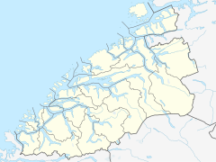 Location of the river  Surna (Norway) (Trøndelag)  Surna (Norway) (Norway) | |
| Location | |
| Country | Norway |
| Counties | Trøndelag, Møre og Romsdal |
| Municipalities | Rindal, Surnadal |
| Physical characteristics | |
| Source | Tiosen |
| • location | Rindal, Trøndelag, Norway |
| • coordinates | 63°05′42″N 09°17′51″E |
| • elevation | 180 metres (590 ft) |
| Mouth | Surnadalsøra |
• location | Surnadal, Møre og Romsdal, Norway |
• coordinates | 62°58′24″N 08°40′07″E |
• elevation | 0 metres (0 ft) |
| Length | 45 km (28 mi) |
| Basin features | |
| River system | Tiåa and Lomunda |
| Tributaries | |
| • left | Gåstjønna, Bølu, Folda, Vinddøla |
See also
- List of rivers in Norway
References
- Store norske leksikon. "Surna" (in Norwegian). Retrieved 2013-04-14.
- Kvien, Jon-Kåre, & Stian Sørli. 2008. Utfordringer med prosjektering av uklassifiserte vassdragsanlegg. Trondheim: SWECO Norge AS.
- Tre nye kraftverk. 2006. Aftenbladet (10 July).
- Kysinga kraft bygger kraftstasjon. 2009. Trollheimsporten (16 June).
This Trøndelag location article is a stub. You can help Wikipedia by expanding it. |
This Møre og Romsdal location article is a stub. You can help Wikipedia by expanding it. |
This article related to a river in Norway is a stub. You can help Wikipedia by expanding it. |
Другой контент может иметь иную лицензию. Перед использованием материалов сайта WikiSort.org внимательно изучите правила лицензирования конкретных элементов наполнения сайта.
WikiSort.org - проект по пересортировке и дополнению контента Википедии