geo.wikisort.org - River
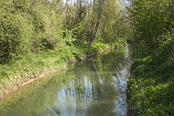
The Slack (French pronunciation: [slak], in Picard locally [s̟laːk]) is a 22-kilometre-long (14 mi) coastal river in the Pas-de-Calais department, in northern France.[1]
This article may be expanded with text translated from the corresponding article in French. (January 2021) Click [show] for important translation instructions.
|
| Slack | |
|---|---|
 The Slack | |
| Native name | La Slack (French) |
| Location | |
| Country | France |
| Physical characteristics | |
| Source | |
| • location | Pas-de-Calais |
| Mouth | |
• location | English Channel |
• coordinates | 50°48′18″N 1°36′5″E |
| Length | 22 km (14 mi) |
It rises at Hermelinghen on Mount Binôt, flows through Rinxent, Marquise, Beuvrequen, Slack (village near Ambleteuse) and flows into the English Channel in Ambleteuse next to Fort Mahon.

References
Wikimedia Commons has media related to Slack River.
На других языках
[de] Slack (Fluss)
Die Slack ist ein Küstenfluss in Frankreich, der im Département Pas-de-Calais in der Region Hauts-de-France verläuft. Sie entspringt im Gemeindegebiet von Hermelinghen, im Regionalen Naturpark Caps et Marais d’Opale, entwässert generell in westlicher Richtung und mündet nach rund 22[2] Kilometern bei Ambleteuse, an der Gemeindegrenze zu Wimereux, in den Ärmelkanal.- [en] Slack (river)
[it] Slack (fiume)
La Slack è un piccolo fiume costiero francese che scorre nel dipartimento del Pas-de-Calais, nella regione Alta Francia e sfocia nella Manica, contribuendovi ad alimentare il fiume marino costiero che fiancheggia gli estuari piccardi fino al Gran Sito dei due Capi.Текст в блоке "Читать" взят с сайта "Википедия" и доступен по лицензии Creative Commons Attribution-ShareAlike; в отдельных случаях могут действовать дополнительные условия.
Другой контент может иметь иную лицензию. Перед использованием материалов сайта WikiSort.org внимательно изучите правила лицензирования конкретных элементов наполнения сайта.
Другой контент может иметь иную лицензию. Перед использованием материалов сайта WikiSort.org внимательно изучите правила лицензирования конкретных элементов наполнения сайта.
2019-2025
WikiSort.org - проект по пересортировке и дополнению контента Википедии
WikiSort.org - проект по пересортировке и дополнению контента Википедии

