geo.wikisort.org - River
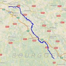
The Serein (French pronunciation: [səʁɛ̃] (![]() listen)) is a river of eastern France. It is the main waterway of the Chablis wine district in Burgundy. It is 188 km (117 mi) long.[1] The Serein is not navigable.
listen)) is a river of eastern France. It is the main waterway of the Chablis wine district in Burgundy. It is 188 km (117 mi) long.[1] The Serein is not navigable.
| Serein | |
|---|---|
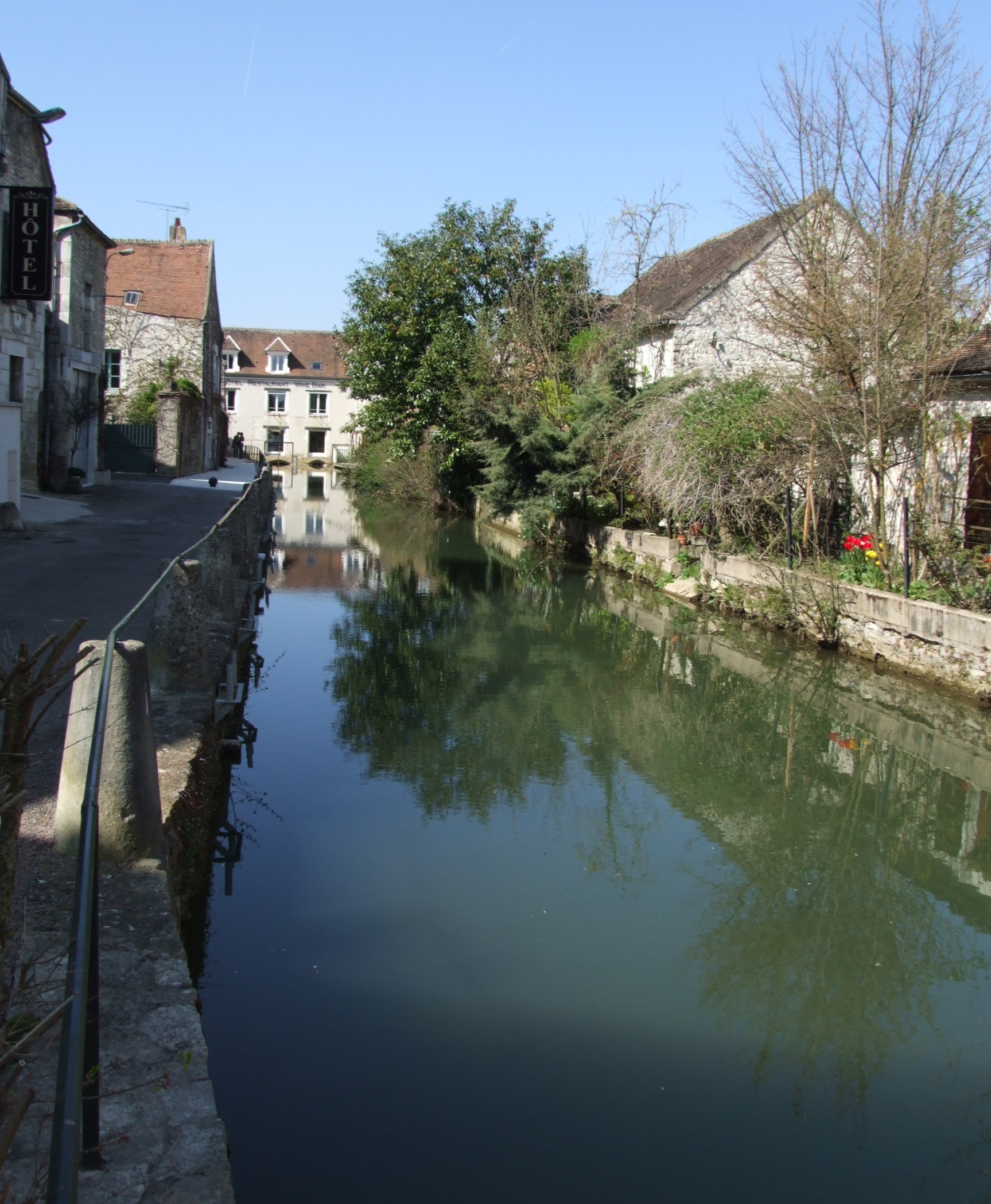 The Serein at Chablis | |
 | |
| Location | |
| Country | France |
| Physical characteristics | |
| Source | |
| • location | Burgundy |
| Mouth | |
• location | Yonne |
• coordinates | 47°55′21″N 3°31′30″E |
| Length | 188 km (117 mi) |
| Basin size | 1,120 km2 (430 sq mi) |
| Basin features | |
| Progression | Yonne→ Seine→ English Channel |
Origin of the name
Serein is the French word for "serene". This may reflect the placid nature of its course, or the strong monastic tradition in the area.
Geography
The Serein rises in the Auxois hills at Arconcey and flows north-north-west into the Yonne at Bassou. Both the A6 Autoroute du Soleil and the Paris-Lyon railway line follow a similar route through the area.
Main tributaries of the Serein and their length
The Serein has the following tributaries over 10 km length:[1]
- Baigne (L) - 14 km
- Soutain (L) - 13 km
- Argentalet (L) - 26 km
- Ru du Champ Millet (R) - 10 km
- Ru de Vaucharme (L) - 16 km
note: R=Right L=Left
Départements and towns crossed
From source to mouth:
- Côte-d'Or: Arconcey, La Motte-Ternant, Époisses
- Yonne: Montréal, L'Isle-sur-Serein, Noyers, Chablis, Pontigny Abbey, Bassou
History
The history of the area is dominated by the Church at Pontigny and nearby Auxerre, whose remit extended to building the famous castle at Noyers.
See also
- Chablis wine
References
На других языках
[de] Serein
Der Serein ist ein Fluss in Frankreich, der in der Region Bourgogne-Franche-Comté verläuft. Er entspringt im Gemeindegebiet von Beurey-Bauguay, auf dem Plateau von Saulieu, einem Teil des nördlichen Morvan, entwässert generell in nordwestlicher Richtung und mündet nach rund 188[2] Kilometern im Gemeindegebiet von Bonnard als rechter Nebenfluss in die Yonne. Auf seinem Weg durchquert der Serein die Départements Côte-d’Or und Yonne, verläuft auf einer kurzen Strecke durch den Regionalen Naturpark Morvan und durchfließt auf einer Länge von fast 15 Kilometern das Weinbaugebiet Chablis.- [en] Serein
Другой контент может иметь иную лицензию. Перед использованием материалов сайта WikiSort.org внимательно изучите правила лицензирования конкретных элементов наполнения сайта.
WikiSort.org - проект по пересортировке и дополнению контента Википедии