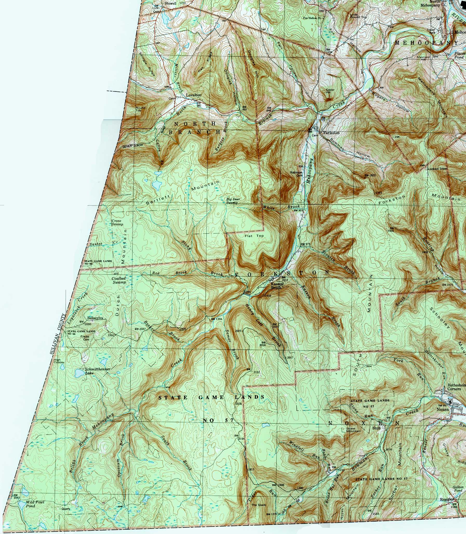
Scouten Brook is a tributary of Mehoopany Creek in Wyoming County, Pennsylvania, in the United States. It is approximately 2.2 miles (3.5 km) long and flows through Forkston Township.[1] The watershed of the stream has an area of 2.66 square miles (6.9 km2). The stream is designated as a High-Quality Coldwater Fishery and has wild trout. It is one of five large brooks to cut through South Mountain.
| Scouten Brook | |
|---|---|
| Physical characteristics | |
| Source | |
| • location | South Mountain in Forkston Township, Wyoming County, Pennsylvania |
| • elevation | 2,192 feet (668 m) |
| Mouth | |
• location | Mehoopany Creek in Forkston Township, Wyoming County, Pennsylvania at Kasson Brook |
• coordinates | 41°29′06″N 76°08′06″W |
• elevation | 948 feet (289 m) |
| Length | 2.2 miles (3.5 km) |
| Basin size | 2.66 square miles (6.9 km2) |
| Basin features | |
| Progression | Mehoopany Creek → Susquehanna River → Chesapeake Bay |
| Tributaries | |
| • right | one unnamed tributary |
Scouten Brook begins on South Mountain in Forkston Township. It flows north-northwest for several tenths of a mile before entering a valley and turning northwest for about a mile. The stream then receives an unnamed tributary from the right and turns west-northwest for several tenths of a mile. It then turns west for several tenths of a mile, leaving its valley, crossing Windy Valley Road, and reaching its confluence with Mehoopany Creek.[1]
Scouten Brook joins Mehoopany Creek 10.14 miles (16.32 km) upstream of its mouth.[2]
The elevation near the mouth of Scouten Brook is 948 feet (289 m) above sea level.[3] The elevation near the stream's source is 2,192 feet (668 m) above sea level.[1]
Scouten Brook is one of five large brooks to divide a large, flat-topped mountain along Mehoopany Creek.[4] This mountain is known as South Mountain and Scouten Brook is the furthest downstream of the five streams. Forkston Mountain is also situated near the stream.[5] In the late 1800s, coal smut was reported at a tract at the headwaters of Scouten Brook.[4]
The watershed of Scouten Brook has an area of 2.66 square miles (6.9 km2).[2] The mouth of the stream is in the United States Geological Survey quadrangle of Dutch Mountain. However, its source is in the quadrangle of Noxen.[3] The mouth of the stream is located at Kasson Brook and is 2 miles (3.2 km) south of Forkston.[2][4]
Wild trout naturally reproduce in Scouten Brook from its headwaters downstream to its mouth.[6] The stream is classified as a High-Quality Coldwater Fishery.[7]
Scouten Brook was entered into the Geographic Names Information System on August 2, 1979. Its identifier in the Geographic Names Information System is 1199963.[3]
Since 2000, a streambank stabilization project has been done on Scouten Brook.[8]