geo.wikisort.org - River
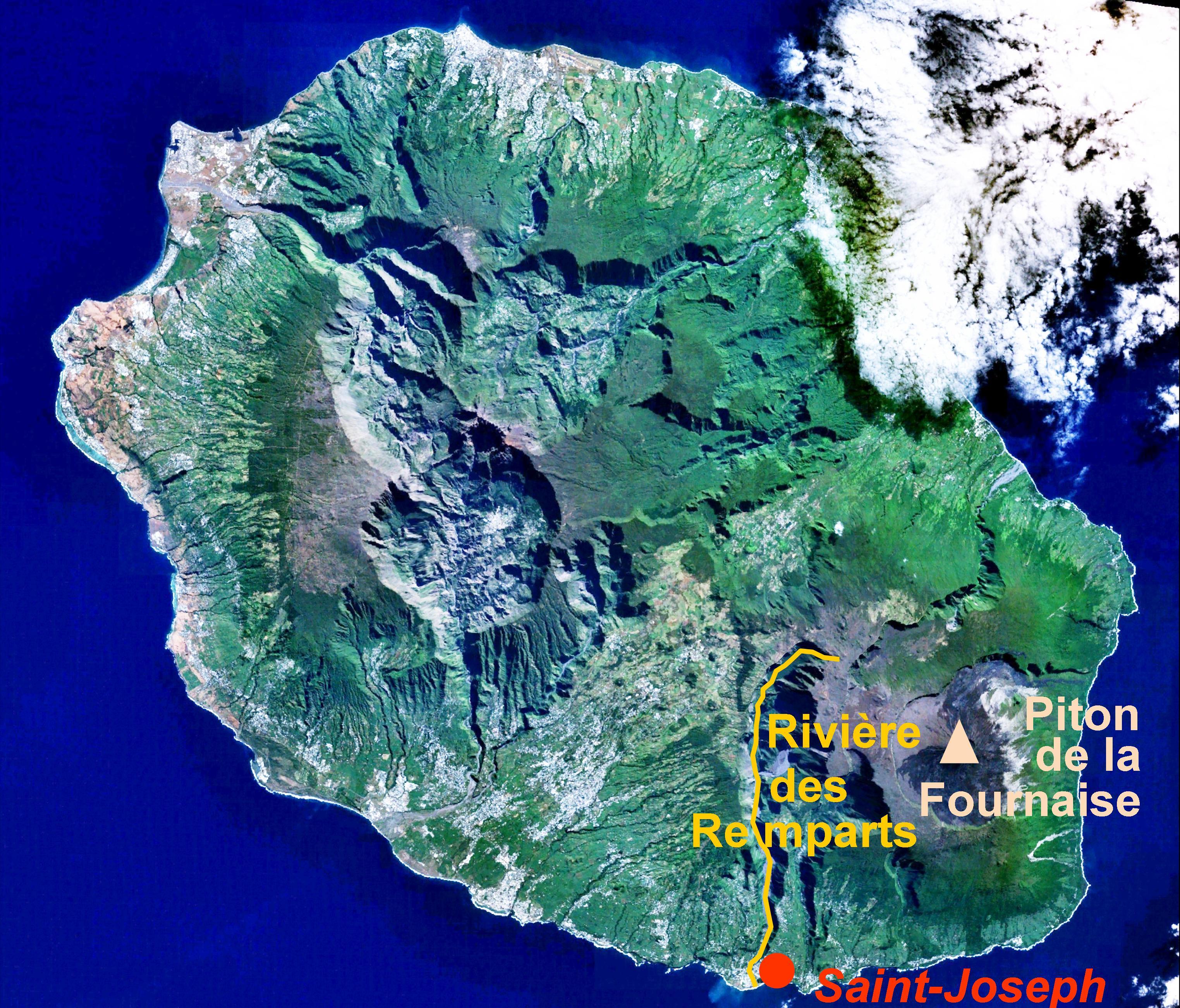
The Rivière des Remparts is a river on the Indian Ocean island of Réunion. It is 27.1 km (16.8 mi) long.[1] It flows south from the slopes of the Piton des Songes, in a deep caldera along the Piton de la Fournaise, reaching the sea at the town of Saint-Joseph. It forms part of the Rivière des Remparts – Rivière Langevin Important Bird Area.[2]
| Rivière des Remparts | |
|---|---|
 Rivière des Remparts valley upstream of Roche-Plate | |
| Location | |
| Country | France |
| Region | Réunion |
| Physical characteristics | |
| Mouth | Indian Ocean |
• coordinates | 21°23′8″S 55°37′7″E |
| Length | 27.1 km (16.8 mi) |
References
- Sandre. "Fiche cours d'eau - Rivière des Remparts (40000100)".
- "Rivière des Remparts – Rivière Langevin". Important Bird Areas factsheet. BirdLife International. 2014. Retrieved 2014-03-06.

This Réunion location article is a stub. You can help Wikipedia by expanding it. |
Текст в блоке "Читать" взят с сайта "Википедия" и доступен по лицензии Creative Commons Attribution-ShareAlike; в отдельных случаях могут действовать дополнительные условия.
Другой контент может иметь иную лицензию. Перед использованием материалов сайта WikiSort.org внимательно изучите правила лицензирования конкретных элементов наполнения сайта.
Другой контент может иметь иную лицензию. Перед использованием материалов сайта WikiSort.org внимательно изучите правила лицензирования конкретных элементов наполнения сайта.
2019-2026
WikiSort.org - проект по пересортировке и дополнению контента Википедии
WikiSort.org - проект по пересортировке и дополнению контента Википедии