geo.wikisort.org - River
The River Lym or River Lim is a short river, some 5 km (3.1 mi) in length, that flows through the Devon-Dorset border. It rises from multiple springs at Raymond's Hill, near the village of Uplyme in East Devon, and flows southeasterly through Dorset, into the English Channel via Lyme Bay in the town of Lyme Regis, Dorset. The river falls over 200 metres from its source.[1][2]
| River Lym | |
|---|---|
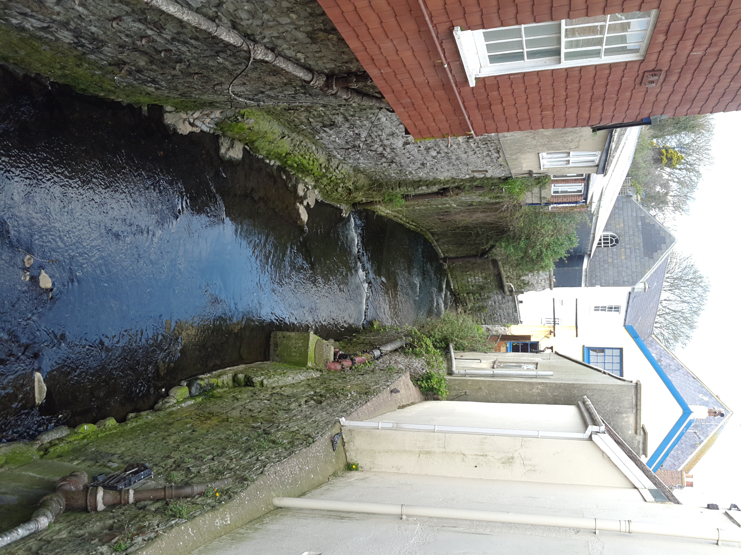 The river in Lyme Regis | |
| Location | |
| Country | United Kingdom |
| Physical characteristics | |
| Source | |
| • location | Raymonds Hill, near Uplyme, East Devon |
| Mouth | |
• location | English Channel, Lyme Bay, Dorset |
• coordinates | 50.7244°N 2.9326°W |
| Length | 5.0 km (3.1 mi) |
Some of the northern parts of the river are partly underground,[3] and some points at Lyme Regis are culverted. Lyme Regis has grown around the southern course of the river, with residential houses, holiday cottages and bridges connected to it. In Saxon times, the abbots of Sherborne Abbey had salt-boiling rights on land adjacent to the River Lym, and in the 12th century the river powered three watermills, however today Town Mill, dating back to at least 1340, is the only watermill still in use.
Etymology
The name is of British origin and probably cognate with the Welsh llif meaning flood or stream. The River Lym (or Lim) appears in the Domesday Book.[3][4]
Course
Some 5 km (3.1 mi) in length, the River Lym rises from a group of springs in Raymond's Hill near the village of Uplyme in East Devon. It flows southward down a steep hill past a cricket ground and tennis courts into Uplyme, before flowing east at Church Street to Tappers Knapp in Devon. After about 1 km (0.621 mi) it resumes a southwesterly course, crossing into Dorset, and flows into the town of Lyme Regis, where it flows past residential houses, holiday cottages and under bridges, alongside Windsor Terrace, then Jericho, before reaching an intersection between Mill Green and Coombe Street – known as the Lynch – where it briefly splits in two, with the east side powering Town Mill – the only present watermill in the area. The west side of the river continues its southerly course and turns slightly west for about 50 m (164 ft), flows for another 150 m (492 ft) under a culvert and eventually Buddle Bridge – an English Grade I listed building[5] – before flowing into the English Channel via Lyme Bay in Lyme Regis. It falls over 200 metres from its source.[1][2][6]
 The River Lym in Uplyme, East Devon, near its source
![The right-side split near Mill Green and Coombe Street (named the Lynch) powers Town Mill[lower-alpha 1]](//upload.wikimedia.org/wikipedia/commons/thumb/d/d2/River_Lym_running_into_Town_Mill.jpg/120px-River_Lym_running_into_Town_Mill.jpg) The right-side split near Mill Green and Coombe Street (named the Lynch) powers Town Mill[lower-alpha 1]
The right-side split near Mill Green and Coombe Street (named the Lynch) powers Town Mill[lower-alpha 1] The river, flowing behind Town Mill
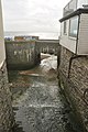 The River Lym flows into the English Channel

![The right-side split near Mill Green and Coombe Street (named the Lynch) powers Town Mill[lower-alpha 1]](http://upload.wikimedia.org/wikipedia/commons/d/d2/River_Lym_running_into_Town_Mill.jpg)


Human activity

The town of Lyme Regis has grown around the south part of the river, with residential houses, holiday cottages, bridges and a watermill connected to it.[2] The River Lim Path is a recreational footpath designated alongside the river.[8] Three other recreational footpaths, the Wessex Ridgeway, Liberty Trail and East Devon Way, coincide with sections of the river.[1] Buddle Bridge, which crosses over the river at Lyme Regis, became a Grade I listed building by Historic England in 1952.[5]
In Saxon times, the abbots of Sherborne Abbey had salt-boiling rights on land adjacent to the River Lym.[9] Town Mill, a watermill dating from 1340, is powered by the River Lym via a leat running along a lynch. The Domesday Book records a mill at Lyme in 1086, so the site may be much older. After being restored, the mill now produces flour.[10] In 2012, graffiti artist Banksy stencilled an origami crane on a wall adjacent to the River Lym at the intersection of Mill Green and Coombe Street.[7]
Flooding
The usual water level of the river at Uplyme is between 0.00m and 0.79m.[11] The river has flooded on several occasions, usually after heavy rainfall. The most costly was in 1890, when residents of Coombe Street had to be evacuated.[2][12]
River Lim Path
The River Lim Path is a public footpath, 2.4 km (1.5 mi) long, that follows the River Lym from Town Mill in Lyme Regis, Dorset to Uplyme in Devon.[8] It was funded and supported by the Coastal Communities Fund, and the footpath also forms part of the East Devon Way. The Uplyme Parish Council published a guide pamphlet.[13] Improvements were coordinated by Lyme Forward and the Dorset Coast Forum in 2018 and 2019,[14][15] and a local furniture maker and artist built animal houses and seating areas themed around the old watermills alongside the path.[8][16]
Notes
References
- Ordnance Survey (1 February 1997) "Explorer Map: Lyme Regis and Bridport Sheet No. 29 (OS Explorer Map)". Retrieved 17 July 2021.
- River Lym (or Lim). LymeRegis.org, "the Pearl of Dorset". Retrieved 17 July 2021.
- James, Alan G. (2008) "A Slippery Customer: proto-Indo-European *(s)lei- and its progeny in some place-names in Britain". (revised, 2010). Society for Name Studies in Britain and Ireland. Retrieved 2 August 2021.
- Ekwall, Eilert (1928) "English River Names". Clarendon Press. Oxford University Press. Retrieved 2 August 2021.
- Buddle Bridge. Historic England. List entry 1110811. Retrieved 17 July 2021.
- Map of Lyme Regis. Visit-Dorset.com. Ordnance Survey. Dorset Council. Retrieved 19 July 2021.
- Banksy's graffiti crane found in Lyme Regis, 29 May 2012. BBC News. Retrieved 17 July 2021.
- River Lim Path. LoveLymeRegis.co.uk. Retrieved 18 July 2021.
- Ralph Wightman (1983) "Portrait of Dorset". (4th edition). Robert Hale Ltd. p. 163. ISBN 0-7090-0844-9.
- Town Mill – official website. TownMill.org. Lyme Regis. Retrieved 17 July 2021.
- River Lim. RiverLevels.uk. Retrieved 18 September 2021.
- East Devon Catchment Flood Management Plan: Summary Report June 2012. Environment Agency. p. 22–23. Retrieved 20 July 2021.
- The River Lim Path, from Lyme Regis to Uplyme. Retrieved 3 August 2021.
- River Lim Path Improvement Project Update (Funded by the Coastal Communities Fund). Uplyme Parish Council. Retrieved 3 August 2021.
- Work to improve a path whilst retaining and enhancing its natural character is underway, 13 May 2018. Bridport News. Retrieved 3 August 2021.
- Welch, Lottie (20 July 2019) New seating and animal homes installed along the River Lim Path. Bridport News. Retrieved 20 July 2021.
Sources
- Matthews. Discover the River Lym. Lyme Bay Holidays.
- 2015 Bathing Water Profile for Lyme Regis Front Beach. Environment Agency - Catchment Data Explorer. environment.data.gov.uk.
External links
- River Lim at Wikishire
This Dorset location article is a stub. You can help Wikipedia by expanding it. |
This Devon location article is a stub. You can help Wikipedia by expanding it. |
Другой контент может иметь иную лицензию. Перед использованием материалов сайта WikiSort.org внимательно изучите правила лицензирования конкретных элементов наполнения сайта.
WikiSort.org - проект по пересортировке и дополнению контента Википедии