geo.wikisort.org - River
The Rauma is a river that runs through Romsdalen, a valley in Møre og Romsdal and Innlandet counties in Norway. It runs for 68 kilometres (42 mi) from Lesjaskogsvatnet, a lake in the municipality of Lesja, to the town of Åndalsnes in the municipality of Rauma. The river was once famous for its salmon-fishing, but since an infection with Gyrodactylus salaris only 5 to 10% of the original stock survives. This, however, has begun to recover rapidly after a successful revitalisation project. The salmon runs up to the Slettafossen, a 16-metre (52 ft) high combination of waterfalls and rapids more than 42 kilometres (26 mi) upriver from the estuary.
| Rauma | |
|---|---|
 View of the river | |
| Location | |
| Country | Norway |
| Physical characteristics | |
| Source | |
| • location | Lesjaskogsvatnet |
| • elevation | 611 m (2,005 ft) above sea level |
| Mouth | |
• location | Åndalsnes/Veblungsnes |
• elevation | 0 m (0 ft) above sea level |
| Length | 68 km (42 mi) |
| Basin size | 1,202 km2 (464 sq mi) |
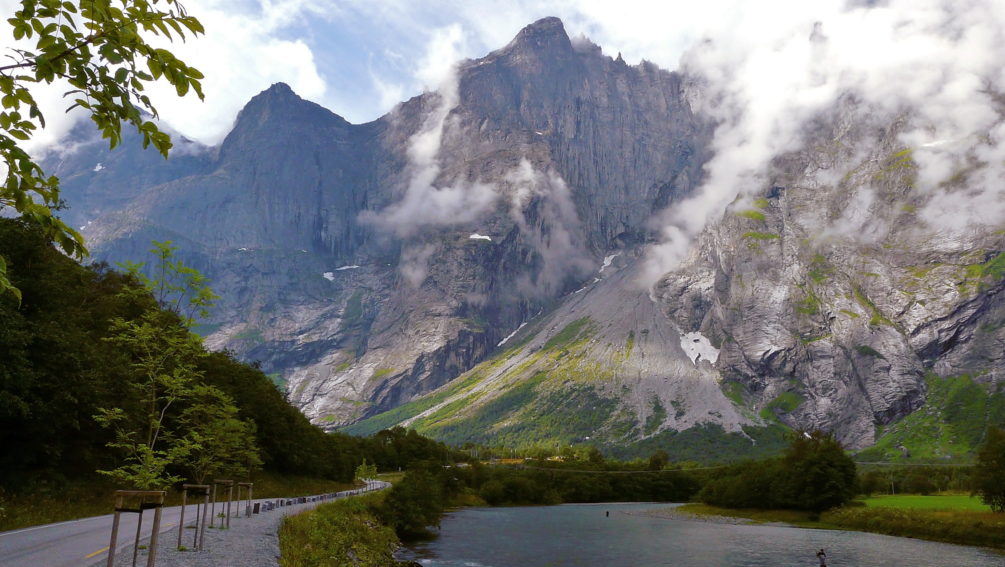
The Rauma River and its valley are regarded as one of the most beautiful in Norway. The river runs very clear with a green tint and the mountains tower some 1,500 to 1,800 metres (4,900 to 5,900 ft) above the river in the lower and middle parts of the valley. The Reinheimen National Park and the Trollveggen cliff are both located along the southwestern shores of the river through the municipality of Rauma. The Romsdalsalpene mountains surround the river and the valley, including the mountains Store Trolltind, Store Venjetinden, Trollryggen, and Romsdalshornet. The Rauma Line railroad follows the river through the valley on its way north to Åndalsnes. The railroad crosses the river on the Kylling Bridge at the village of Verma.
The Rauma was classified as a protected watercourse in 1992, and the only main tributary affected by hydroelectric power is the Verma River with the over 300-metre (980 ft) Vermafossen falls. The biggest tributaries are the Ulvåa and Istra. The Istra runs through the Ister Valley, well known for Trollstigen Road in its upper parts.[1]
The origins of the name Rauma are unknown.
Media gallery
 Stuguflåt Bridge
 Kylling Bridge
 Mouth of the river at Åndalsnes
 Close up picture of the river
 Mountains surrounding the river valley


References
- Store norske leksikon. "Rauma – elv" (in Norwegian). Retrieved 2010-10-27.
External links
 Media related to Rauma River at Wikimedia Commons
| Authority control |
|
|---|
This Innlandet location article is a stub. You can help Wikipedia by expanding it. |
This Møre og Romsdal location article is a stub. You can help Wikipedia by expanding it. |
This article related to a river in Norway is a stub. You can help Wikipedia by expanding it. |
На других языках
[de] Rauma (Fluss)
Die Rauma ist ein steiler Wildfluss in den norwegischen Provinzen Innlandet und Møre og Romsdal. Er durchfließt das landschaftlich schöne Hochtal (Romsdal) und mündet später in den Romsdalsfjord bei Åndalsnes. Ruhige seenartige Strecken wechseln sich mit stark verblockten Gefällstrecken ab.- [en] Rauma (river)
[it] Rauma (fiume)
Il Rauma è un fiume che scorre nelle contee di Innlandet e Møre og Romsdal, in Norvegia. Scorre per 68 km da Lesjaskogsvatnet a Åndalsnes nella municipalità di Rauma. Il fiume ha una diga, un idroimpianto ed è conosciuto per essere un buon fiume per pescare i salmoni.[ru] Рёума (река)
Рёума (норв. Rauma) — река на юго-западе Норвегии в фюльке Оппланн и Мёре-ог-Ромсдал. Длина реки составляет всего 68 км, при этом площадь бассейна равна 1202 км².Другой контент может иметь иную лицензию. Перед использованием материалов сайта WikiSort.org внимательно изучите правила лицензирования конкретных элементов наполнения сайта.
WikiSort.org - проект по пересортировке и дополнению контента Википедии