geo.wikisort.org - River
Potton Brook rises east of Gamlingay, Cambridgeshire, and flows southwest and then south through Potton[1] and the John O'Gaunt Golf Club and into Sutton, Bedfordshire. Potton Brook curves west and northwest, and joins the River Ivel northeast of Lower Caldecote.
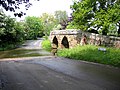 A packhorse bridge and ford across Potton Brook at Sutton in Bedfordshire

| Potton Brook | |
|---|---|
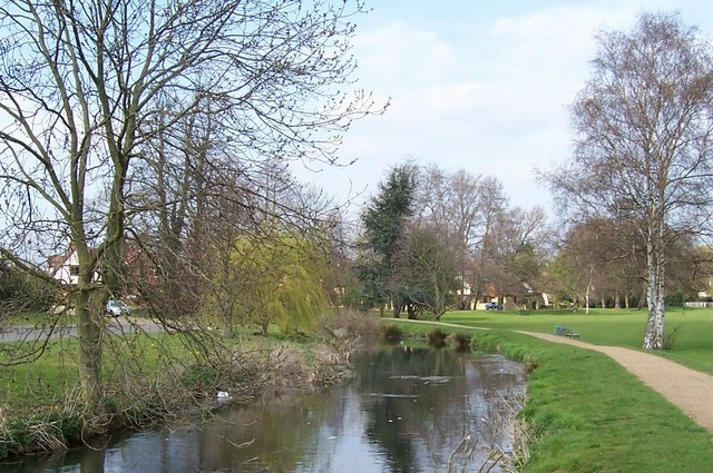 Potton Brook in Potton Park, Potton | |
| Location | |
| Country | England |
| Unitary Authority | Central Bedfordshire |
| Physical characteristics | |
| Source | |
| • location | east of Gamlingay, Cambridgeshire, England |
| • coordinates | 52°9′5.13″N 0°9′39.54″W |
| Mouth | |
• location | Bedfordshire, England |
• coordinates | 52°6′48″N 0°16′37″W |
• elevation | 25 m (82 ft) |
| Discharge | |
| • location | Sandy |
References
- "Potton-Sutton Circular Walk". Ivel Countryside project and Befordshire County Council. Retrieved 4 January 2017.
| Unitary authorities |
|
|---|---|
| Major settlements |
|
| Topics |
|
This Bedfordshire location article is a stub. You can help Wikipedia by expanding it. |
Текст в блоке "Читать" взят с сайта "Википедия" и доступен по лицензии Creative Commons Attribution-ShareAlike; в отдельных случаях могут действовать дополнительные условия.
Другой контент может иметь иную лицензию. Перед использованием материалов сайта WikiSort.org внимательно изучите правила лицензирования конкретных элементов наполнения сайта.
Другой контент может иметь иную лицензию. Перед использованием материалов сайта WikiSort.org внимательно изучите правила лицензирования конкретных элементов наполнения сайта.
2019-2026
WikiSort.org - проект по пересортировке и дополнению контента Википедии
WikiSort.org - проект по пересортировке и дополнению контента Википедии