geo.wikisort.org - River
The Plotnikova (Russian: Плотникова)[1] is a river in the western Kamchatka Peninsula, Russia, a tributary of the Bolshaya. It is used for spawning by various species of Pacific salmon.
| Plotnikova | |
|---|---|
 Plotnikova river: a fishing ground for char (Salvelinus) | |
 | |
| Native name | Плотникова (Russian) |
| Location | |
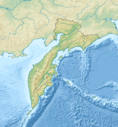
| Country | Russia |
| Federal subject | Kamchatka Krai |
| District | Yelizovsky District, Ust-Bolsheretsky District |
| Physical characteristics | |
| Mouth | |
• coordinates | 52.886677°N 156.537531°E |
| Basin features | |
| Progression | Bolshaya→ Sea of Okhotsk |
| Tributaries | |
| • right | Sokoch |
Course
The Plotnikova flows through the Yelizovsky and Ust-Bolsheretsky districts of the Kamchatka Territory. It originates in Lake Nachikinsky (Russian: озеро Начикинское) at an altitude of 348 metres (1,142 ft), and flows into the Bolshaya 58 kilometres (36 mi) from the river's mouth on west coast of Kamchatka on the Sea of Okhotsk. The river is about 134 kilometres (83 mi) long, and has a catchment area of 4,450 square kilometres (1,720 sq mi).[2] The part of the Bolshaya upstream from its confluence with the Plotnikova is named Bystraya.[3]
Settlement
Bolsheretsk was founded in 1703 as a fort on the Plotnikova. In 1707 rebels destroyed the fort. In 1711 it was rebuilt where the Bystraya and Plotnikova rivers join to form the Bolshaya, 58 kilometres from the river mouth on the Sea of Okhotsk.[citation needed] In the late 1920s the village was abandoned and the inhabitants moved to the new village of Kavalerskoye, and to village of Ust-Bolsheretsk at the mouth of the Bolshaya, which from 1926 became the center of Ust-Bolsheretsky District.[4]
Fish
The river is used by locals and tourists for fishing from rafts or boats. Fish species include rainbow trout, char, grayling, Chinook salmon, coho salmon, sockeye salmon, chum salmon and pink salmon.[5]
References
- Словарь названий гидрографических объектов России и других стран — членов СНГ, Federal Service for Geodesy and Cartography of Russia, 1999, p. 301
- Государственный водный реестр.
- Fishing on Bolshaya river.
- Смышляев, Александр 2011, pp. 38–40.
- Fishing in Kamchatka.
Sources
- "Fishing in Kamchatka : Fishing Autotour on the Rivers of Kamchatka", kamchatka.org, retrieved 2020-02-10
- "Fishing on Bolshaya river", kamchatka-fishing.ru, retrieved 2020-02-02
- "Государственный водный реестр : Река Плотникова (State Water Registry : Plotnikova River)", textual.ru (in Russian), Ministry of Natural Resources of Russia, 29 March 2009, retrieved 2020-02-10
- Смышляев, Александр (2011), Камчатский край Большерецкие веси (in Russian), Петропавловск-Камчатский: Новая книга, pp. 38–40
На других языках
[de] Plotnikowa (Fluss)
Die Plotnikowa (russisch Плотникова) ist ein 134 Kilometer langer linker Nebenfluss der Bolschaja, die oberhalb der Einmündung Bystraja heißt, im Süden der Kamtschatka-Halbinsel im Fernen Osten Russlands.- [en] Plotnikova (river)
[ru] Река Плотникова
Река Плотникова — река на полуострове Камчатка в России. Протекает по территории Елизовского и Усть-Большерецкого районов Камчатского края. Длина реки — около 134[2] км. Площадь водосборного бассейна — 4450[2] км².Другой контент может иметь иную лицензию. Перед использованием материалов сайта WikiSort.org внимательно изучите правила лицензирования конкретных элементов наполнения сайта.
WikiSort.org - проект по пересортировке и дополнению контента Википедии