geo.wikisort.org - River
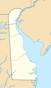
Pepper Creek is a stream approximately 8 mi (13 km) long in southern Delaware in the United States.
 | This article needs additional citations for verification. (June 2014) |
| Pepper Creek | |
|---|---|
   | |
| Location | |
| Country | United States |
| State | Delaware |
| County | Sussex |
| City | Frankford |
| Physical characteristics | |
| Source | On the watershed divide between Pepper Creek and Pocomoke River |
| • location | Frankford, Delaware |
| • coordinates | 38°32′07″N 075°17′14″W[1] |
| • elevation | about 40 feet amsl |
| Mouth | just south of Oak Orchard, Delaware |
• location | Clarksville, Delaware |
• coordinates | 38°35′16″N 075°10′03″W[1] |
• elevation | sea level (0 ft.) |
| Basin features | |
| Progression | northeast |
| River system | Indian River |
It rises in Cypress Swamp in southern Sussex County, approximately 3 mi (5 km) north of the Maryland state line. It flows generally east-northeast, past Dagsboro and into Indian River Bay, an inlet of the Atlantic Ocean, approximately 2 mi (3 km) northwest of Millville.
The upper course of the creek is connected by channelized ditches through Cypress Swamp to the headwaters of the Pocomoke River.
See also
- List of Delaware rivers
References
- "GNIS Detail - Pepper Creek". geonames.usgs.gov. US Geological Survey. Retrieved 29 May 2019.
 State of Delaware | ||
|---|---|---|
Dover (capital) | ||
| Topics |
|  |
| Society |
| |
| Cities |
| |
| Towns |
| |
| Counties |
| |
 Delaware portal | ||
Текст в блоке "Читать" взят с сайта "Википедия" и доступен по лицензии Creative Commons Attribution-ShareAlike; в отдельных случаях могут действовать дополнительные условия.
Другой контент может иметь иную лицензию. Перед использованием материалов сайта WikiSort.org внимательно изучите правила лицензирования конкретных элементов наполнения сайта.
Другой контент может иметь иную лицензию. Перед использованием материалов сайта WikiSort.org внимательно изучите правила лицензирования конкретных элементов наполнения сайта.
2019-2026
WikiSort.org - проект по пересортировке и дополнению контента Википедии
WikiSort.org - проект по пересортировке и дополнению контента Википедии