geo.wikisort.org - River
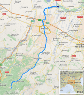
The Parma is a large stream, 92 kilometres (57 mi) long, that begins in the Tuscan-Emilian Apennine mountains and flows in Parma valley.
| Parma | |
|---|---|
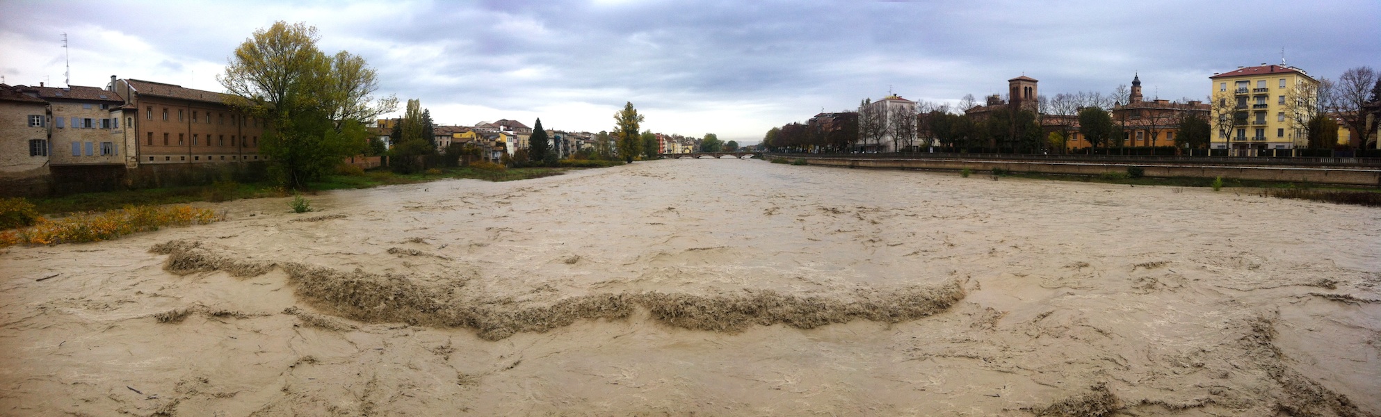
 Parma: Lungoparma | |
 | |
| Location | |
| Country | Italy |
| Physical characteristics | |
| Source | |
| • location | Tuscan-Emilian Apennines, Monte Marmagna |
| • elevation | about 1,852 m (6,076 ft) |
| Mouth | |
• location | Po near Mezzani (PR) |
• coordinates | 44°56′06″N 10°26′28″E |
| Length | 92 km (57 mi) |
| Basin size | 796 km2 (307 sq mi) |
| Discharge | |
| • average | mean value 11.3 m3/s (400 cu ft/s) at mouth, up to 1,000 m3/s (35,000 cu ft/s) in full flood |
| Basin features | |
| Progression | Po→ Adriatic Sea |
Path
It begins from the lake Lago Santo parmense (outflow called Parma di Lago Santo) and small lakes Gemio and Scuro (outflow called Parma di Badignana). After only 4 kilometres (2.5 mi) Parma di Lago Santo meets Parma di Badignana and then the river takes the name of Parma. It flows through the Province of Parma into Parma, dividing the city in two, and then continues to the Po.
Local names
- Lungoparma is the local name for the urban area of the city of Parma along the river.
- la Parma is the way parmesans call the stream and its bed (to not to be confused with il Parma, the local name for the Parma F.C.)
- la Parma voladora indicates the Parma stream in full flood.
References
- Information for this article was taken from the Italian and French versions.
На других языках
- [en] Parma (river)
[it] Parma (torrente)
La Parma[1] è un torrente italiano di 92 km, affluente di destra del fiume Po, che si sviluppa per intero all'interno della provincia di Parma, in Emilia-Romagna. Ha un'area di bacino di 815 km²[2].Текст в блоке "Читать" взят с сайта "Википедия" и доступен по лицензии Creative Commons Attribution-ShareAlike; в отдельных случаях могут действовать дополнительные условия.
Другой контент может иметь иную лицензию. Перед использованием материалов сайта WikiSort.org внимательно изучите правила лицензирования конкретных элементов наполнения сайта.
Другой контент может иметь иную лицензию. Перед использованием материалов сайта WikiSort.org внимательно изучите правила лицензирования конкретных элементов наполнения сайта.
2019-2026
WikiSort.org - проект по пересортировке и дополнению контента Википедии
WikiSort.org - проект по пересортировке и дополнению контента Википедии