geo.wikisort.org - River
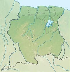
Para Creek (Dutch: Parakreek also Para River) is a blackwater creek in the Wanica & Para District of Suriname.[2] It is a tributary of the Suriname River, and was home to many plantations. The area around the creek has been cultivated since the English period.[3] The Para District has been named after the creek in 1966.[4]
| Para Creek Para River | |
|---|---|
 Painting of the Para Creek near plantation Berseba (~1860) | |
| Native name | Parakreek (Dutch) |
| Location | |
| Country | Suriname |
| District | Wanica & Para District |
| Physical characteristics | |
| Source | |
| • coordinates | 5.4015°N 55.1624°W |
| Mouth | Suriname River |
• coordinates | 5.74642°N 55.12789°W |
| Length | 77.65 kilometres (48.25 mi)[1] |
| Basin features | |
| Progression | Suriname River→Atlantic Ocean |
Overview
The Para Creek is fed by many small creeks from the savanna area, and has a drainage basin of 1,650 square kilometres (640 sq mi).[5] During the colonisation of Suriname, most plantations were built along the Suriname River and the Para Creek, because the ground was fertile, and no additional infrastructure was required.[5] In the 20th century, many holiday resorts were built on the Para Creek and its tributaries.[6]
The northern part of Para Creek near the mouth experiences minor tidal movements, but has no salinity.[2] The southern part of the creek used to be home to many wood plantations.[7] The last 25 kilometres (16 mi) of the Para Creek are parallel to the Suriname River,[1] therefore, the Paradoorsnede, an artificial canal, was dug in the 18th century to provide better access.[7] The canal is 3.4 kilometres (2.1 mi) long.[1]
Fort Para
In 1685, Fort Para was constructed on the Para Creek near Houttuin to protect the plantations against attacks by the Amerindians, however in 1686 a peace treaty was signed between the tribes and Governor van Aerssen van Sommelsdijck.[8] In 1740, the fort was demolished.[9]
References
- Planbureau 2014, p. 22.
- "Flora en Fauna". Wianofru (in Dutch). Retrieved 7 May 2021.
- "Parakreek". Suriname Plantages (in Dutch). Retrieved 7 May 2021.
- Planbureau 2014, p. 1.
- Planbureau 2014, p. 11.
- Planbureau 2014, p. 17.
- "Herstel regiem van de Pararivier". Star Nieuws (in Dutch). Retrieved 7 May 2021.
- "Geschiedenis & achtergrond". Houttuyn (in Dutch). Retrieved 7 May 2021.
- "Forten en verdedigingswerken". Suriname.nu (in Dutch). Retrieved 7 May 2021.
Bibliography
| Wikimedia Commons has media related to Parakreek. |
- Planbureau (2014). "Waterbeheersingsplan Pararivier en Zijkreken" (PDF). Planning Office Suriname (in Dutch).
На других языках
[de] Para (Fluss)
Der Para ist ein Fluss im Norden von Suriname, in den Distrikten Brokopondo und Para. Er ist ein linker Nebenfluss des Suriname und entsteht in der Savannenlandschaft der Distrikte Para und Brokopondo aus mehreren Bachläufen, wovon der Para- und Saramaccakreek die bekanntesten sind. Nach der Vereinigung dieser Bäche in der Nähe des Ortes und der früheren Plantage Berlijn münden der linke Nebenbach Sabakoe und anschließend die wichtigsten rechten Nebenbäche, der Carolina und der Buffels ein. Der Buffelskreek empfängt viel Wasser aus der Vereinigung des Anjoemara- und Malasibaches, die beide in den Savannen des Brokopondo-Distriktes entspringen. In der alten Küstenfläche nimmt der Para als linken Nebenbach den Coropina, zusammen mit dem Tawaycoura- und nördlich des Ortes Overtoom, den Jawasi auf. Weiter nördlich fließend nimmt er noch den Pararac als linken Nebenbach auf und strömt bei der Plantage Houttuin, in der Nähe des Ortes Paranam in den Suriname. Hier lag von 1685 bis 1740 am linken Ufer das Fort Para.- [en] Para Creek
Другой контент может иметь иную лицензию. Перед использованием материалов сайта WikiSort.org внимательно изучите правила лицензирования конкретных элементов наполнения сайта.
WikiSort.org - проект по пересортировке и дополнению контента Википедии
