geo.wikisort.org - River
The Noguera Ribagorzana (Spanish: [noˈɣeɾa riβaɣoɾˈθana]) or Noguera Ribagorçana (Catalan: [nuˈɣeɾə riβəɣuɾˈsanə]) is a river in northern Spain.[1]
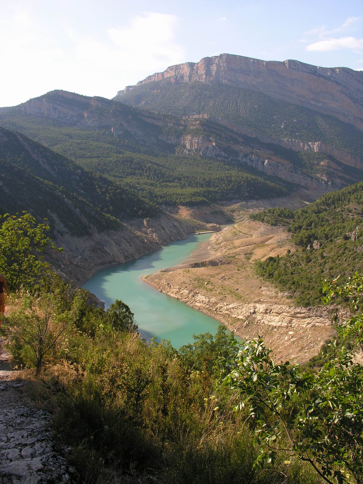
For much of its course of 130 km it forms the administrative boundary between Catalonia and Aragon. Its source is in the municipality of Vielha e Mijaran (Aran Valley) at an elevation of about 2400 m, and its upper valley forms the main access route to the Aran Valley (N-230 road and the Vielha tunnel (5230 m long) under the watershed). It passes through the traditional county of Ribagorza and the town of Pont de Suert (Alta Ribagorça). Dams form two large reservoirs, the Escales below Pont de Suert and the Canelles above Ivars de Noguera (Noguera). The Noguera Ribagorzana joins the Segre from the right at Vilanova de la Barca (Segrià). It drains a basin of 2036 km2.
See also
References
- Dorothy Noyes Fire in the Placa: Catalan Festival Politics After Franco 2003 p. ix "Catalonia proper — a triangle with the Pyrenees as one side, the Mediterranean as another, the Noguera Ribagorçana and Ebre rivers approximately marking the third, and Barcelona, the capital, in the middle — is now an autonomous region "
| Authority control |
|
|---|
This article about a location in Catalonia is a stub. You can help Wikipedia by expanding it. |
This article about a location in Aragon, Spain, is a stub. You can help Wikipedia by expanding it. |
На других языках
[de] Noguera Ribagorzana
Die Noguera Ribagorzana (Spanisch) oder Noguera Ribagorçana (Katalanisch) ist ein 133 Kilometer langer Nebenfluss des Segre, dessen Ober- und Mittellauf im Großen und Ganzen die Grenze zwischen Aragonien und Katalonien in Spanien bildet. Sie entspringt in den Llacs de Mulleres im Massiv des Pico de Aneto (Pyrenäen) auf zirka 2450 m Höhe. Ihr Oberlauf in den Pyrenäen bis zum Stausee des Pantà d’Escales wird von einer der Hauptverbindungen zwischen Spanien und Frankreich, der N 230 begleitet. Im Mittellauf, wo sie im Pantà de Santa Anna und Pantà de Canelles gestaut wird, verengt sich das Tal, und die Straße verlässt es. Südlich von Montañana teilt sie durch den Engpass von Mont Rebei die Serra del Montsec in den Montsec de l’Estall im Westen und den Montsec d’Ares im Osten. Bei Corbins mündet die Noguera in den Segre, einige Kilometer oberhalb von Lleida.- [en] Noguera Ribagorçana
[es] Noguera Ribagorzana
El Noguera Ribagorzana es un río español afluente del río Segre por la margen derecha de la cuenca del río Ebro. Nace en los Lagos de Mulleres en el valle de Mulleres a 2.750 metros de altura,[1] en la vertiente S de la divisoria formada por el macizo de Maladeta - Aneto - Salenques - Gerbosa - Puerto de Viella - Rius. Desemboca en el Segre, en el término municipal de Corbins (en la comarca del Segriá, en la provincia de Lérida). Durante 100 de los 130 kilómetros de su curso forma la línea divisoria entre Cataluña y Aragón.[it] Noguera Ribagorzana
La Noguera Ribagorzana è un fiume della Spagna che nasce dai Laghi di Mulleres (Val d'Aran), a 2750 metri di altitudine s.l.m. [1] sul versante meridionale della catena di monti formata dal massiccio di Maladeta - Aneto - Salenques - Gerbosa - Puerto de Viella - Rius e dopo un percorso di 133 chilometri sbocca nel fiume Segre a Corbins.[ru] Ногера-Рибагорсана
Ногера-Рибагорсана (исп. Noguera Ribagorzana) — река в Каталонии, Испания, правый приток реки Сегре[1]. Длина реки — 133 км.[источник не указан 742 дня]Другой контент может иметь иную лицензию. Перед использованием материалов сайта WikiSort.org внимательно изучите правила лицензирования конкретных элементов наполнения сайта.
WikiSort.org - проект по пересортировке и дополнению контента Википедии