geo.wikisort.org - River
The Niers (German pronunciation: [niːɐ̯s], Dutch: [niːrs]) is a river in Germany and The Netherlands, a right tributary of the river Maas (Meuse). Its wellspring is near Erkelenz, south of Mönchengladbach, in North Rhine-Westphalia (Germany).
| Niers | |
|---|---|
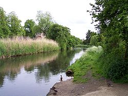
 The Niers at Weeze | |
 Overview map | |
| Location | |
| Countries |
|
| Physical characteristics | |
| Source | |
| • location | Lower Rhine region |
| • coordinates | 51°04′49″N 6°23′31″E |
| • elevation | ±75 m (246 ft) |
| Mouth | |
• location | Maas |
• coordinates | 51°42′50″N 5°56′51″E |
| Length | 113.1 km (70.3 mi) [1] |
| Basin size | 1,373 km2 (530 sq mi) [1] |
| Basin features | |
| Progression | Meuse→ North Sea |
Course and length
The Niers flows through Mönchengladbach, Viersen, Wachtendonk, Geldern and Goch before flowing into the Meuse just across the border with the Netherlands, in Gennep, Limburg (Netherlands).
Its overall length is 116 km - 108 km in Germany, 8 km in the Netherlands.
See also
References
External links
На других языках
[de] Niers
Die Niers ist ein östlicher und rechter Zufluss der Maas in Deutschland und in den Niederlanden. Sie ist – ohne den linksseitigen Quellbach Wockerrather Fließ oder Kaulhauser Fließ (4,5 km) – 113,1 km lang, davon fließen 8 km durch die Niederlande; mit dem Quellbach sind es insgesamt 117,6 km[2] Fließstrecke.- [en] Niers
[ru] Нирс
Нирс (нем. Niers) или Нерс (нидерл. Neers)[1] — река в Германии и Нидерландах, правый приток Мааса. На территории нидерландской провинции Лимбург находится приустьевой участок реки, на всём остальном протяжении течёт по германской земле Северный Рейн-Вестфалия[2][3].Текст в блоке "Читать" взят с сайта "Википедия" и доступен по лицензии Creative Commons Attribution-ShareAlike; в отдельных случаях могут действовать дополнительные условия.
Другой контент может иметь иную лицензию. Перед использованием материалов сайта WikiSort.org внимательно изучите правила лицензирования конкретных элементов наполнения сайта.
Другой контент может иметь иную лицензию. Перед использованием материалов сайта WikiSort.org внимательно изучите правила лицензирования конкретных элементов наполнения сайта.
2019-2025
WikiSort.org - проект по пересортировке и дополнению контента Википедии
WikiSort.org - проект по пересортировке и дополнению контента Википедии