geo.wikisort.org - River
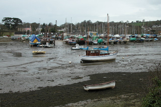
Mylor Creek (Cornish: Pol Scathow, meaning creek of boats) is a tidal ria in south Cornwall, United Kingdom. It is a tributary of Carrick Roads, the estuary of the River Fal and is situated approximately six miles (10 km) south of Truro and two miles (3 km) north of Falmouth .[1]

Geography
The creek is in Mylor civil parish[2] and forms an inland tidal lake. It is approximately 800 feet (240 m) at its widest point and just over a mile (1.8 km) long from its tidal limit at Mylor Bridge to its mouth at Mylor Churchtown where it discharges into Carrick Roads.[1]
Locations
- Normal Tidal Limit (NTL) at Mylor Bridge coordinates 50.18396°N 5.07727°W grid reference SW 803 361
- Mouth (Mylor Harbour) coordinates 50.17882°N 5.05369°W grid reference SW 821 354
History
At the entrance to the creek was the most westerly naval dockyard and victualling station in Britain, which, at high tide, covered 66 acres (27 ha) of water.[3] During the second half of the 19th-century it was the base for HMS Ganges, a training ship for boys, and also the Falmouth Packets. During World War II the harbour was a base for operations conducted by the French Resistance. It is now home to the last remaining fleet of oyster fishermen.[4]
Recreation
Carrick Roads and Cornwall's English Channel coast are popular for yachting and dinghy racing. Restronguet Sailing Club (which takes its name from Restronguet Creek a mile to the north) has its base at Mylor Harbour,[5] a large yacht marina immediately north of Mylor Churchtown.[6]
References
- Ordnance Survey: Landranger map sheet 204 Truro & Falmouth ISBN 978-0-319-23149-4
- "Cornwall Council interactive mapping". Archived from the original on 5 May 2010. Retrieved 5 February 2012. Cornwall Council online mapping. Retrieved May 2010
- "Mylor Regatta". The Cornishman. No. 115. 23 September 1880. p. 3.
- "Mylor". Cornwall Guide. Retrieved 29 April 2017.
- "Archived copy". Archived from the original on 22 November 2012. Retrieved 19 January 2013.
{{cite web}}: CS1 maint: archived copy as title (link) Restronguet Sailing Club website; retrieved May 2010 - "Mylor Yacht Harbour – Marina moorings and lay-up". Archived from the original on 28 March 2010. Retrieved 31 May 2010. Mylor Harbour website. Retrieved May 2010
![]() Media related to Mylor Creek at Wikimedia Commons
Media related to Mylor Creek at Wikimedia Commons
Cornwall Portal | |
| Unitary authorities |
|
| Major settlements |
|
| Rivers | |
| Topics |
|
This Cornwall location article is a stub. You can help Wikipedia by expanding it. |
Другой контент может иметь иную лицензию. Перед использованием материалов сайта WikiSort.org внимательно изучите правила лицензирования конкретных элементов наполнения сайта.
WikiSort.org - проект по пересортировке и дополнению контента Википедии