geo.wikisort.org - River
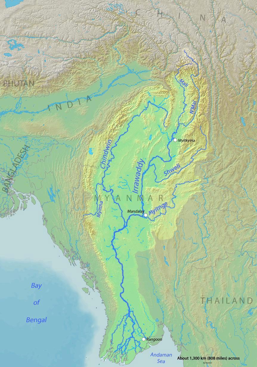
The Mali River (Mali Hka) is a river that originates in the hills of Kachin State, in the northern border of Myanmar. It flows approximately 320 km, when it meets with the N'Mai River and forms the Ayeyarwady River.
| Mali River Mali Hka | |
|---|---|
 Mali Hka near Machanbaw | |
 | |
| Location | |
| Country | Myanmar |
| Physical characteristics | |
| Source | |
| • location | Kachin Hills |
| Mouth | |
• location | Confluence with the N'Mai River |
• coordinates | 25°42′37″N 97°30′10″E |
• elevation | 150 m (490 ft) |
| Length | 320 kilometres (200 mi) |
| Basin features | |
| River system | Ayeyarwady |
History
Construction of the Myitsone Dam has begun at the confluence of the Mali and the N'Mai River.[1]
See also
- List of rivers in Burma
References
На других языках
- [en] Mali River
[ru] Мали (река)
Мали, Намкиу[1], Маливан[2] — река, образующая при слиянии с Нмай реку Иравади.Текст в блоке "Читать" взят с сайта "Википедия" и доступен по лицензии Creative Commons Attribution-ShareAlike; в отдельных случаях могут действовать дополнительные условия.
Другой контент может иметь иную лицензию. Перед использованием материалов сайта WikiSort.org внимательно изучите правила лицензирования конкретных элементов наполнения сайта.
Другой контент может иметь иную лицензию. Перед использованием материалов сайта WikiSort.org внимательно изучите правила лицензирования конкретных элементов наполнения сайта.
2019-2026
WikiSort.org - проект по пересортировке и дополнению контента Википедии
WikiSort.org - проект по пересортировке и дополнению контента Википедии