geo.wikisort.org - River
The Loosahatchie River is a 64.0-mile-long (103.0 km)[1] stream in southwestern Tennessee. Except for a few miles near its head, its mouth, and near the middle of its length, it has been entirely channelized, as have its major tributaries, for agriculture purposes. Its drainage basin was once the site of extensive cotton plantings, which have been greatly diminished in recent decades by extensive urbanization of the area.
This article needs additional citations for verification. (June 2011) |
| Loosahatchie River | |
|---|---|
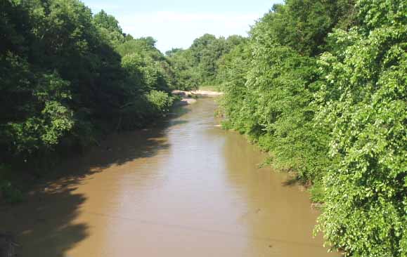 The Loosahatchie River at Arlington, Tennessee | |
| Location | |
| Country | United States |
| State | Tennessee |
| Physical characteristics | |
| Source | |
| • location | Hardeman County, Tennessee |
| • elevation | 207 ft (63 m) |
| Mouth | |
• location | Mississippi River |
| Length | 64 mi (103 km) |
The Loosahatchie rises in the westernmost part of Hardeman County, Tennessee, and flows largely east to west throughout its length. It enters Fayette County, Tennessee, flowing through Somerville, and is crossed west of there by Interstate 40 in the only unchannelized portion of its midcourse. It then flows into Shelby County. Its mouth is slightly north of the Memphis suburb of Frayser. It meets the Mississippi north of the mouth of the Wolf River near Mud Island. Slightly downstream from its mouth in the main Mississippi channel is the Loosahatchie Bar, which is named for it.
The name "Loosahatchie River" is partially redundant—the word "hatchie" is one of many words for "river" in several Muskogean languages native to the Southeast.
See also
- List of Tennessee rivers
References
- U.S. Geological Survey. National Hydrography Dataset high-resolution flowline data. The National Map Archived 2012-03-29 at the Wayback Machine, accessed June 3, 2011
Authority control | |
|---|---|
| General |
|
| National libraries | |
На других языках
[de] Loosahatchie River
Der Loosahatchie River ist ein 103 km langer Nebenfluss des Mississippi im südwestlichen Tennessee. Mit Ausnahme weniger Kilometer nahe der Mündung, in seinem Quellgebiet und im Mittellauf wurde der Fluss und seine Zuflüsse stark begradigt, um der Bewässerung der Landwirtschaft zu dienen. Sein Einzugsgebiet war einst Zentrum ausgedehnter Plantagen für Baumwolle, die durch die starke Urbanisierung der letzten Jahrzehnte verdrängt wurden. Der Name des Flusses ist teilweise redundant, weil hatchie in mehreren Sprachen der Indianer des Südostens Fluss bedeutet.- [en] Loosahatchie River
Другой контент может иметь иную лицензию. Перед использованием материалов сайта WikiSort.org внимательно изучите правила лицензирования конкретных элементов наполнения сайта.
WikiSort.org - проект по пересортировке и дополнению контента Википедии