geo.wikisort.org - River
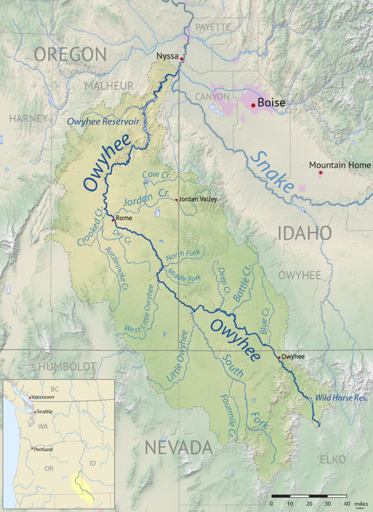
The Little Owyhee River is a 61-mile (98 km) long[3] tributary of the South Fork Owyhee River. Beginning at an elevation of 6,739 feet (2,054 m)[2] east of the Santa Rosa Range in eastern Humboldt County, Nevada, it flows generally east into Elko County, Nevada and the Owyhee Desert. From there, it flows north into Owyhee County, Idaho[4][5] and reaches its mouth at an elevation of 4,363 feet (1,330 m).[1]
Map of the Little Owyhee River flowing north through Nevada into Idaho where it joins the South Fork of the Owyhee before joining the main river.
|
| Little Owyhee River | |
|---|---|
 Much of the Little Owyhee River's water comes from the Owyhee Mountain range | |
 Location of the mouth of the Little Owyhee River in Idaho  Little Owyhee River (the United States) | |
| Location | |
| Country | United States |
| State | Nevada, Idaho |
| Counties | Humboldt County, Nevada, Elko County, Nevada, Owyhee County, Idaho |
| Physical characteristics | |
| Source | |
| • location | east of the Santa Rosa Range, Humboldt County, Nevada |
| • coordinates | 41°48′30″N 117°17′03″W[1] |
| • elevation | 6,739 ft (2,054 m)[2] |
| Mouth | South Fork Owyhee River |
• location | Owyhee County, Idaho |
• coordinates | 42°10′03″N 116°52′19″W[1] |
• elevation | 4,363 ft (1,330 m)[1] |
| Length | 61 mi (98 km)[3] |
See also
References
- "Little Owyhee River". Geographic Names Information System. United States Geological Survey. June 21, 1979. Retrieved July 15, 2013.
- Source elevation derived from Google Earth search using GNIS source coordinates.
- "National Hydrography Dataset". United States Geological Survey. Retrieved July 15, 2013.
- Nevada Road and Recreation Atlas (Map) (3rd ed.). 1:280,000. Benchmark Maps. 2011. pp. 33–34. ISBN 978-0-929591-92-6. OCLC 690965951.
- Idaho Road and Recreation Atlas (Map) (2nd ed.). 1:250,000. Benchmark Maps. 2010. p. 80. ISBN 978-0-929591-06-3. OCLC 567571371.
External links
| Authority control |
|
|---|
This article related to a river in Nevada is a stub. You can help Wikipedia by expanding it. |
This article related to a river in Idaho is a stub. You can help Wikipedia by expanding it. |
Текст в блоке "Читать" взят с сайта "Википедия" и доступен по лицензии Creative Commons Attribution-ShareAlike; в отдельных случаях могут действовать дополнительные условия.
Другой контент может иметь иную лицензию. Перед использованием материалов сайта WikiSort.org внимательно изучите правила лицензирования конкретных элементов наполнения сайта.
Другой контент может иметь иную лицензию. Перед использованием материалов сайта WikiSort.org внимательно изучите правила лицензирования конкретных элементов наполнения сайта.
2019-2026
WikiSort.org - проект по пересортировке и дополнению контента Википедии
WikiSort.org - проект по пересортировке и дополнению контента Википедии