geo.wikisort.org - River
The Lewis River is a tributary of the Columbia River, about 95 miles (153 km) long, in southwestern Washington in the United States. It drains part of the Cascade Range north of the Columbia River. The drainage basin of the Lewis River covers about 1,046 square miles (2,709 km2).[4] The river's mean annual discharge is about 6,125 cubic feet per second (173.4 m3/s).[5] Unlike nearby Lewis County and Fort Lewis the Lewis River was not named for Meriwether Lewis, but rather for A. Lee Lewis, an early colonizer who homesteaded near the mouth of the river.[6]
| Lewis River | |
|---|---|
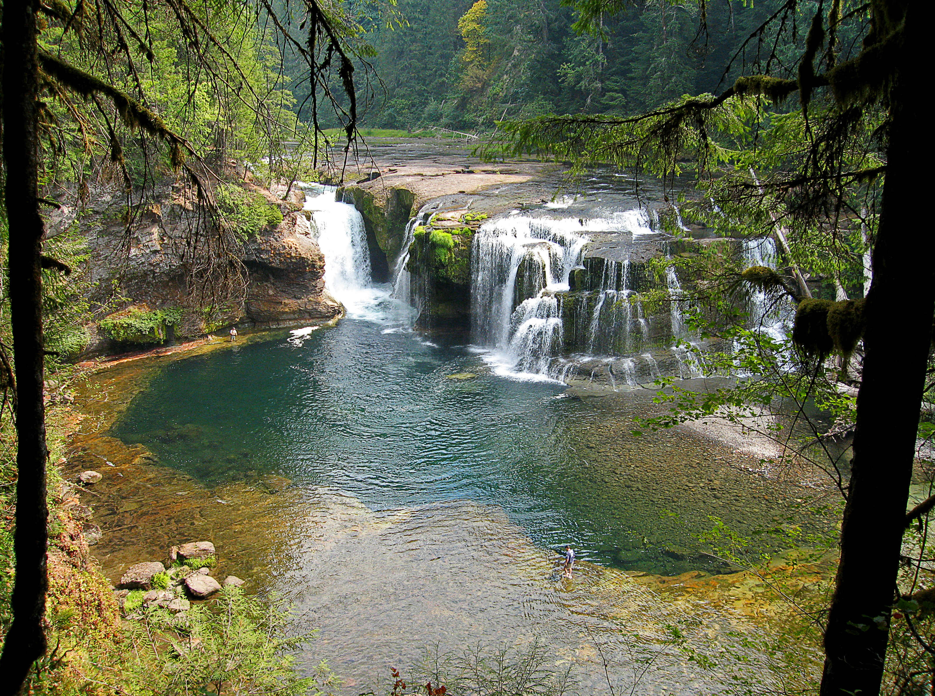 Lower Falls of the Lewis River | |
 Location of the mouth of the Lewis River in Washington  Lewis River (Washington) (the United States) | |
| Etymology | A. Lee Lewis, early settler |
| Location | |
| Country | United States |
| State | Washington |
| County | Skamania, Clark, and Cowlitz |
| Physical characteristics | |
| Source | Mount Adams |
| • location | Cascade Range, Skamania County, Washington |
| • coordinates | 46°13′28″N 121°31′44″W[1] |
| • elevation | 7,194 ft (2,193 m)[2] |
| Mouth | Columbia River |
• location | opposite St. Helens, Oregon, and on the border between Cowlitz and Clark counties, Washington |
• coordinates | 45°51′04″N 122°46′49″W[1] |
• elevation | 10 ft (3.0 m)[1] |
| Length | 95 mi (153 km)[3] |
| Basin size | 1,046 sq mi (2,710 km2)[4] |
| Discharge | |
| • location | mouth (average); max and min at Ariel, WA[5] |
| • average | 6,125 cu ft/s (173.4 m3/s)[5] |
| • minimum | 807.2 cu ft/s (22.86 m3/s) |
| • maximum | 129,000 cu ft/s (3,700 m3/s) |
History
Like almost all Native tribes, Indigenous groups on the Lewis River experienced a population collapse as a result of an 1830 epidemic introduced by early colonizers. This is one of the reasons many early recorded observations include large shifts and changes in tribal populations. Tribal listings compiled by anthropologist Verne F. Ray mention a village about 5 miles (8.0 km) upstream from the mouth of the Lewis, which was originally populated by the Cowlitz, but transitioned after 1830 to a Klickitat population.[7] Lewis and Clark encountered a tribe on the Lewis River that they referred to as "Cathlapotles," which are thought to be Chinook, but they also recorded a Sahaptin-speaking village near the mouth of the Lewis, which were likely Klickitat people.[7]
One of the first recorded sightings of the Lewis by a non Indigenous person was in 1792, when William Robert Broughton passed the mouth of the Lewis while exploring the Columbia River during the Vancouver Expedition. He named it Rushleigh's River at that time. At the time Lewis and Clark crossed the river, they had already named the Snake River the Lewis,[8] and referred to the present-day Lewis as the Cathlapoote. Other historically recorded names include the Kattlepoutal and Washington River.[9]
The Donation Land Claim Act of 1850 brought an influx of colonizers to the region, but just prior to that in 1845, Adolphus Lee Lewis retired from the Hudson's Bay Company and established a land claim near present day Woodland.[10] Lewis became the county surveyor in 1856, and applied his own name to the river.[9]
Course

The Lewis River rises in the Cascades in northeastern Skamania County, high on the west flank of Mount Adams, approximately 75 miles (121 km) northeast of Portland, Oregon. It flows generally southwest through Gifford Pinchot National Forest, across central Skamania County, passing south of Mount St. Helens. It forms the boundary, along the Dark Divide on its north side, between Cowlitz County, to the north, and Clark County, to the south. Towns along the river include Cougar, Ariel, and Woodland. In its lower 10 miles (16 km), it turns sharply south, then west, and enters the Columbia from the east, opposite St. Helens, Oregon, approximately 15 miles (24 km) north of Vancouver, Washington. The mouth of the Lewis River is at Columbia river mile (RM) 87 or river kilometer (RK) 140.[5]

Near the confluence with the Columbia River, the Lewis River is joined by the East Fork Lewis River. The main Lewis River, sometimes called the North Fork Lewis River,[1] forms the boundary between Clark and Cowlitz counties, while the East Fork divides Clark County in half. The East Fork flows westward from headwaters on the western flanks of Lookout Mountain in Skamania County. Parks along the East Fork include Moulton Falls, Lucia Falls, Lewisville, and Paradise Point. A variant name of the East Fork is the South Fork Lewis River.[11]
River modifications
The North Fork is impounded for hydroelectricity and flood control in its middle course by Swift Dam, forming Swift Reservoir; Yale Dam, forming Yale Lake; and Merwin Dam, forming Lake Merwin.
Horseshoe Lake in Woodland is a former oxbow of the North Fork. Beginning in 1940, the construction of Washington State Highway 99 (later to become the Interstate 5 corridor in this area), resulted in the construction of a dike that straightened the river to the east of the highway before it flows under what is now Interstate 5 near the Woodland southern boundary.
See also
- List of rivers of Washington
- Tributaries of the Columbia River
References
- "Lewis River". Geographic Names Information System (GNIS). United States Geological Survey (USGS). October 10, 1979. Retrieved October 13, 2008.
- Source elevation derived from Google Earth search using GNIS source coordinates.
- "Online Topographic Maps from the United States Geological Survey". TopoQuest. Retrieved October 14, 2008.
- "Description: Lewis River Drainage, Mount St. Helens, Washington". United States Geological Survey. 1999. Retrieved October 14, 2008.
- Lower Columbia Fish Recovery Board (December 2004). "Volume II – Subbasin Plan Chapter G – NF and EF Lewis" (PDF). Lower Columbia Salmon Recovery and Fish & Wildlife Subbasin Plan. Northwest Power and Conservation Council. Archived from the original (PDF) on February 13, 2012. Retrieved October 14, 2008.
- Phillips, James W. (1971). Washington State Place Names. University of Washington Press. ISBN 0-295-95158-3.
- Hunn, Eugene (October 11, 2003). Anthropological Study of Yakama Tribe: Traditional Resource Harvest Sites West of the Crest of the Cascades Mountains in Washington State and below the Cascades of the Columbia River (PDF). University of Washington Dept of Anthropology. pp. 10–11. Retrieved October 21, 2019.
- Murray, Edmond (January 1920). "Origin of Washington Geographic Names". The Washington Historical Quarterly. 11 (1): 117.
- Topinka, Lyn. "Lewis River, Washington". Columbia River Images. Retrieved October 22, 2019.
- "History of Woodland". Lewis River Valley. Retrieved October 22, 2019.
- "East Fork Lewis River". Geographic Names Information System (GNIS). United States Geological Survey (USGS). September 10, 1979. Retrieved October 13, 2008.
External links
- USGS: Lewis River Basin
- North Fork Lewis River Photo Essay Documentary produced by Oregon Field Guide
Authority control | |
|---|---|
| General |
|
| National libraries | |
На других языках
[de] Lewis River (Columbia River)
Der Lewis River ist ein 153 km langer Nebenfluss des Columbia Rivers im Südwesten des US-Bundesstaates Washington. Er entwässert einen Teil der Kaskadenkette nördlich des Columbia Rivers.- [en] Lewis River (Washington)
[ru] Льюис (приток Колумбии)
Льюис (англ. Lewis River) — река на юго-западе штата Вашингтон, США. Правый приток реки Колумбия. Длина составляет около 153 км[2]; площадь бассейна — около 2709 км²[3]. Средний расход воды в районе устья составляет 173 м³/с[4].Другой контент может иметь иную лицензию. Перед использованием материалов сайта WikiSort.org внимательно изучите правила лицензирования конкретных элементов наполнения сайта.
WikiSort.org - проект по пересортировке и дополнению контента Википедии