geo.wikisort.org - River
Langfossen is a waterfall located in Etne Municipality in Vestland county, Norway. The waterfall is located about 5 kilometres (3.1 mi) southwest of the village of Fjæra. The water falls down a towering mountain, a total distance of about 612 metres (2,008 ft) before the water leaps out into Åkrafjorden at the base of the mountain. European route E134 runs along the base of the waterfall, making access very easy.
| Langfossen Langfoss | |
|---|---|
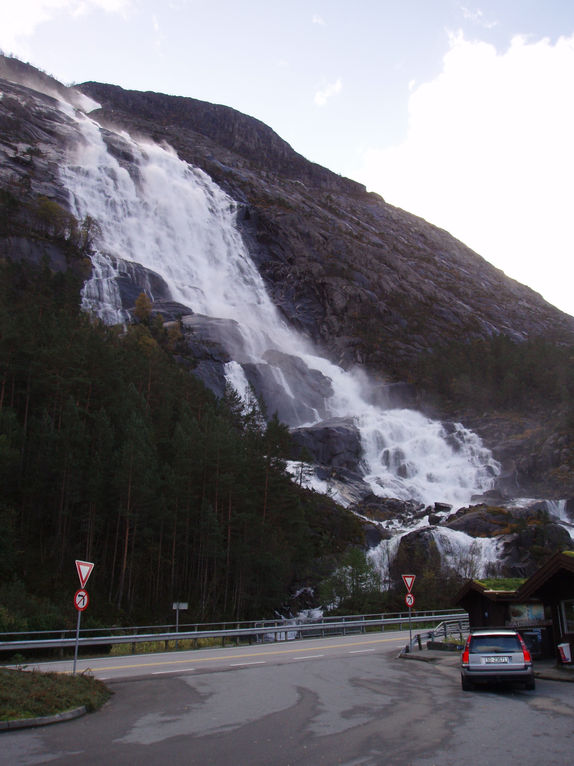 View of the Langfossen waterfall (2006) | |
  | |
| Location | Vestland, Norway |
| Coordinates | 59.8400276°N 6.343217529°E |
| Type | Sliding horsetail |
| Elevation | 228 metres (748 ft) |
| Total height | 612 metres (2,008 ft) |
| Number of drops | 1 |
| Longest drop | 612 metres (2,008 ft) |
| Total width | 107 metres (351 ft) |
| Average width | 76 metres (249 ft) |
| Run | 710 metres (2,330 ft) |
| Average flow rate | 8 m3/s (280 cu ft/s) |
The World Waterfall Database declared this waterfall to be one of the "best in the world".[1] In March 2011 CNN/Budget Travel sat Langfossen as one of the worlds ten most beautiful waterfalls. The waterfall is one of the few in Norway that has not been used in hydroelectric power generation, so it is still in its natural state.[2]
Gallery


See also
- List of waterfalls#Norway
References
- "Langfoss". World Waterfall Database. Retrieved 2015-04-01.
- Collins, Beth (2011-03-11). "10 most beautiful waterfalls". CNN.
This Vestland location article is a stub. You can help Wikipedia by expanding it. |
На других языках
- [en] Langfossen
[ru] Лангфоссен
Лангфоссен (норв. Langfossen) — водопад каскадного типа, расположенный на реке Вауле (норв. Vaulaelva) в муниципалитете Этне в западной Норвегии.Другой контент может иметь иную лицензию. Перед использованием материалов сайта WikiSort.org внимательно изучите правила лицензирования конкретных элементов наполнения сайта.
WikiSort.org - проект по пересортировке и дополнению контента Википедии