geo.wikisort.org - River
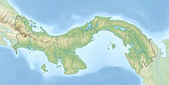
La Villa River is a river of Panama, in the province of Los Santos in the peninsula of Azuero. It arises in the province of Herrera in a national park, the Montuoso. It forms the border between Herrera and Los Santos and is an important source of drinking water for both provinces. The water also is used for irrigation. The La Villa River is 150 kilometres (93 mi) long. La Villa de Los Santos is at the left edge of the river.[1]
| La Villa River | |
|---|---|
 | |
| Location | |
| Country | Panama |
| Province | Los Santos Province, Herrera Province |
| Physical characteristics | |
| Mouth | |
• coordinates | 7°59′47″N 80°23′15″W |
| Length | 150 km (93 mi) |
See also
References
- "Rio La Villa". GeoNames. Retrieved July 27, 2021.
- Rand McNally, The New International Atlas, 1993.
- CIA map, 1995.
Текст в блоке "Читать" взят с сайта "Википедия" и доступен по лицензии Creative Commons Attribution-ShareAlike; в отдельных случаях могут действовать дополнительные условия.
Другой контент может иметь иную лицензию. Перед использованием материалов сайта WikiSort.org внимательно изучите правила лицензирования конкретных элементов наполнения сайта.
Другой контент может иметь иную лицензию. Перед использованием материалов сайта WikiSort.org внимательно изучите правила лицензирования конкретных элементов наполнения сайта.
2019-2025
WikiSort.org - проект по пересортировке и дополнению контента Википедии
WikiSort.org - проект по пересортировке и дополнению контента Википедии
