geo.wikisort.org - River
The Kingsbridge Estuary (also, erroneously, known as the 'Salcombe Estuary') in the South Hams area of Devon, England runs from Kingsbridge in the north to its mouth at the English Channel near Salcombe and lies between Bolt Head and Sharpitor to the west and Portlemouth Down to the east. The estuary is some 8.6 kilometres (5.3 mi) in length, with numerous side channels. Several of its creeks have independent names, including Blanksmill, Frogmore, Southpool, Batson and Bowcombe Creek (the most northerly portion of the estuary).
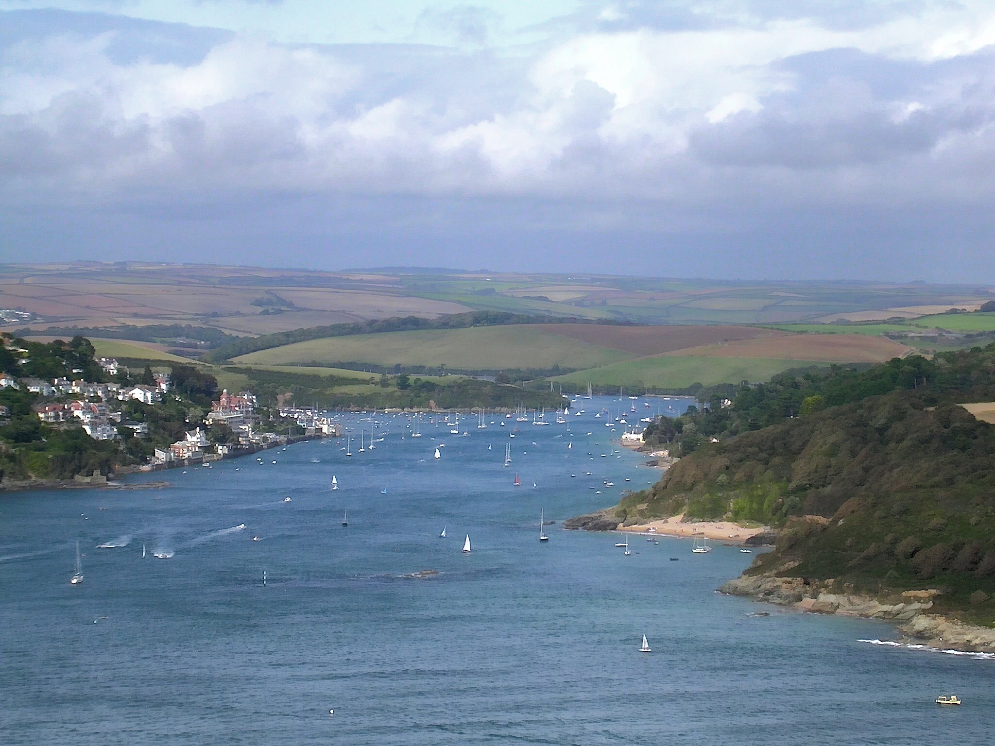
It covers an area of 674ha of which 446 ha are inter-tidal. At high water the length of coast within the ria is 48.6 kilometres (30.2 mi). Although there are no major water courses entering the estuary, its total catchment area is 6,800 hectares (68 km2).
The estuary is an extreme example of a ria or drowned valley caused by rising sea levels rather than a true estuary. Prior to the sea level rise at the end of the last glacial period, it was the valley of a river. Its size is disproportionate to the size of the small streams which flow into it.[1]
In February 1987 the estuary was designated a Site of Special Scientific Interest. It is a Local Nature Reserve and lies within the South Devon Area of Outstanding Natural Beauty (AONB).
References
- "The Salcombe & Kingsbridge Estuary". South Devon AONB. 22 June 2008. Archived from the original on 5 November 2012. Retrieved 10 August 2012.
This Devon location article is a stub. You can help Wikipedia by expanding it. |
На других языках
- [en] Kingsbridge Estuary
[ru] Кингсбридж (эстуарий)
Кингсбридж (англ. Kingsbridge Estuary), также Солком (англ. Salcombe Estuary) — эстуарий в районе Саут-Хэмс графства Девон в Англии, соединяющийся с водами Ла-Манша близ Солкома[en] и вдающийся в сушу на север до Кингсбриджа. Лиман очень популярен среди туристов и любителей ходить под парусом и входит в Южнодевонскую Область исключительной природной красоты[en] (ОИПК[en]).Другой контент может иметь иную лицензию. Перед использованием материалов сайта WikiSort.org внимательно изучите правила лицензирования конкретных элементов наполнения сайта.
WikiSort.org - проект по пересортировке и дополнению контента Википедии