geo.wikisort.org - River
Jacobs Creek is a 33.4-mile-long (53.8 km)[6] tributary of the Youghiogheny River beginning in Acme, Pennsylvania and draining at its mouth in the town of Jacobs Creek into the Youghiogheny River. Jacobs Creek is the southwestern border of Westmoreland County and the northwestern border of Fayette County. The area was a major producer of rye whiskey in the decades before Prohibition.[7]
| Jacobs Creek Tributary to Youghiogheny River | |
|---|---|
 Creek Falls (Chaintown, PA) | |
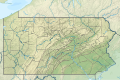 Location of Jacobs Creek mouth  Jacobs Creek (Youghiogheny River tributary) (the United States) | |
| Location | |
| Country | United States |
| State | Pennsylvania |
| Counties | Westmoreland, PA, Fayette, PA |
| Cities | Scottdale, PA, Mt. Pleasant, PA |
| Physical characteristics | |
| Source | Green Lick Run divide |
| • location | about 1 mile south Bear Rocks, Pennsylvania[1] |
| • coordinates | 40°05′58″N 079°27′02″W[2] |
| • elevation | 2,070 ft (630 m)[1] |
| Mouth | Youghiogheny River |
• location | Jacobs Creek, Westmoreland, PA[3] |
• coordinates | 40°07′37″N 79°44′35″W[2] |
• elevation | 761 ft (232 m)[3] |
| Length | 31.73 mi (51.06 km)[4] |
| Basin size | 94.81 square miles (245.6 km2)[5] |
| Discharge | |
| • location | Youghiogheny River |
| • average | 133.11 cu ft/s (3.769 m3/s) at mouth with Youghiogheny River[5] |
| Basin features | |
| Progression | generally east[4] |
| River system | Monongahela River |
| Tributaries | |
| • left | Latta Run |
| • right | Laurel Run Brush Run Shupe Run Sherrick Run Stauffer Run Meadow Run Barren Run |
| Waterbodies | Bridgeport Reservoir |
Variant names
According to the Geographic Names Information System, it has also been known historically as:[2]
- Jacob's Creek
Geography
Jacobs Creek, between Chaintown and its mouth, cuts a deep gorge through the Fayette Anticline, exposing many rock outcroppings and even exposures of the Freeport Coal seam.
The geography of Jacobs Creek allowed early civilization in the Jacobs Creek Valley as early as 1768 when western Pennsylvania was opened to settlement by the Treaty of Fort Stanwix. According to Rambling in the Valley of Jacobs Creek (Medsger & Rowe):
Various industrial enterprises have been associated with the history of this valley. Among the first were the manufacture of salt and iron. By the treaty of Fort Stanwix in 1768 this region was opened for settlement and many people from the eastern part of the state were locating in this "land of promise". Both salt and iron were in demand, they were expensive and hard to procure, hence men of enterprise naturally sought means to supply these demands. George Dallas Albert in his "History of Westmoreland County", says that, "Foremost of the wants of these early settlers was the want of salt." He also states that "in the Youghiogheny region, twenty bushels of wheat was not thought an unfair exchange for a bushel of salt; or a cow and calf for a similar amount."
Other geographic features of the valley include two waterfalls: Freeman Falls and Creek Falls.[8]
History

Jacobs Creek was named for Chief Jacob, a Native American.[9] The valley of Jacobs Creek is home to an abundance of colonial and industrial history, including the home of the Alliance Furnace, the oldest standing iron furnace west of the Allegheny Mountains.[citation needed] The Alliance Furnace was built before ownership of the land was obtained by William Turnbul, John Holker, and Peter Marmie on July 13, 1789. The furnace was blown in 1802.
Starting in the 1790s Jacobs Creek attracted a number of Mennonite farmers.[10] One of those Mennonites was Henry Oberholtzer (anglicized to "Overholt").[7] In 1800 Henry and his son Abraham cleared 150 acres near West Overton to start a farm.[7] The farm grew rye for distilling into whiskey. The whiskey later became known as Old Overholt.[7] Western Pennsylvania was a major producer of rye whiskey in the decades before Prohibition.[7]
Other sources of industry along the valley include salt mills, grist mills, coke ovens, strip mining, and iron ore mining.[11]
On December 19, 1907, an explosion in the Darr Coal Mine killed 239 men and boys.
Recreation
Recreation along Jacobs Creek includes smallmouth bass and trout fishing, seasonal whitewater kayaking, and swimming. It has been the inspiration of the guide Ramblings in the Valley of Jacobs Creek.[citation needed]
Kayaking
- Acme to Laurelville (Class III-IV)
- Chaintown to Youghiogheny River (Class II-III)
- Freeman Falls (Class IV)
- Creek Falls (Class V Backwards U-Type Waterfall)[12]
See also
- List of rivers of Pennsylvania
- Jacob's Creek Bridge (1801). The first iron-chain suspension bridge built in the United States.
References
| Wikimedia Commons has media related to Jacobs Creek (Pennsylvania). |
- "Get Maps". USGS Topoview. US Geological Survey. Retrieved 18 November 2020.
- "GNIS Detail - Jacobs Creek". geonames.usgs.gov. US Geological Survey. Retrieved 18 November 2020.
- "Get Maps". USGS Topoview. US Geological Survey. Retrieved 18 November 2020.
- "ArcGIS Web Application". epa.maps.arcgis.com. US EPA. Retrieved 18 November 2020.
- "Jacobs Creek Watershed Report". US EPA Geoviewer. US EPA. Retrieved 18 November 2020.
- U.S. Geological Survey. National Hydrography Dataset high-resolution flowline data. The National Map Archived 2012-04-05 at WebCite, accessed August 15, 2011
- Wondrich, David (2 September 2016). "The Rise & Fall of America's Oldest Whiskey". The Daily Beast. Retrieved 3 October 2016.
- Ramblings in the Valley of Jacobs Creek
- Linder, Lee (Jul 9, 1970). "Happenings in Pennsylvania". Observer-Reporter. pp. B3. Retrieved 23 May 2015.
- Van Atta, Robert B. (15 June 2003). "Mennonites were early immigrants to Jacob's Creek area in 1790s". TribLive. Pittsburgh: Pittsburgh Tribune. Retrieved 15 December 2016.
- Alliance Furnace
- American Whitewater – PA State Rivers
Другой контент может иметь иную лицензию. Перед использованием материалов сайта WikiSort.org внимательно изучите правила лицензирования конкретных элементов наполнения сайта.
WikiSort.org - проект по пересортировке и дополнению контента Википедии