geo.wikisort.org - River
Jack Elliott Creek is a stream in the Capital Regional District of British Columbia, Canada. Located on southern Vancouver Island, it flows from its source to its mouth as a right tributary of Loss Creek.[3][1][4][5]
| Jack Elliott Creek | |
|---|---|
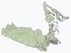 Location of the mouth of Jack Elliott Creek  Jack Elliott Creek (British Columbia) | |
| Location | |
| Country | Canada |
| Province | British Columbia |
| District | Capital Regional District |
| Physical characteristics | |
| Source | unnamed slope |
| • coordinates | 48°31′35″N 124°13′27″W[1] |
| • elevation | 783 m (2,569 ft)[2] |
| Mouth | Loss Creek |
• coordinates | 48°29′33″N 124°16′00″W[3] |
• elevation | 117 m (384 ft) |
Natural history
The mouth of the creek, below British Columbia Highway 14, falls within Juan de Fuca Provincial Park.[4][5]
Course
Jack Elliott Creek begins at an unnamed slope on the San Juan Ridge[1] at an elevation of 783 metres (2,569 ft).[2] It flows southwest, passes under British Columbia Highway 14, and reaches its mouth as a right tributary of Loss Creek at an elevation of 117 metres (384 ft), south east of the settlement of Port Renfrew. Loss Creek flows to the Strait of Juan de Fuca on the Pacific Ocean.[3][1][4][5]
References
- "Toporama (on-line map and search)". Atlas of Canada. Natural Resources Canada. Retrieved 2020-10-22.
- "Google Earth". Retrieved 2020-10-22.
- "Jack Elliott Creek". Geographical Names Data Base. Natural Resources Canada. Retrieved 2020-10-22.
- "Jack Elliott Creek". BC Geographical Names. Retrieved 2020-10-22.
- "Juan de Fuca Marine Trail map" (PDF). BC Parks. Retrieved 2020-10-22.
Текст в блоке "Читать" взят с сайта "Википедия" и доступен по лицензии Creative Commons Attribution-ShareAlike; в отдельных случаях могут действовать дополнительные условия.
Другой контент может иметь иную лицензию. Перед использованием материалов сайта WikiSort.org внимательно изучите правила лицензирования конкретных элементов наполнения сайта.
Другой контент может иметь иную лицензию. Перед использованием материалов сайта WikiSort.org внимательно изучите правила лицензирования конкретных элементов наполнения сайта.
2019-2025
WikiSort.org - проект по пересортировке и дополнению контента Википедии
WikiSort.org - проект по пересортировке и дополнению контента Википедии