geo.wikisort.org - River
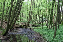
Ichte, in its upper course also called Steinaer Bach, is a river of Thuringia and Lower Saxony, Germany.
This article may be expanded with text translated from the corresponding article in German. (October 2018) Click [show] for important translation instructions.
|
| Ichte | |
|---|---|
 | |
| Location | |
| Country | Germany |
| States | Thuringia and Lower Saxony |
| Physical characteristics | |
| Source | |
| • location | East of the Oder Dam |
| • coordinates | 51.6552°N 10.5453°E |
| Mouth | |
• location | northeast of Pützlingen, a district of Werther, into the Helme |
• coordinates | 51.5243°N 10.6295°E |
| Basin features | |
| Progression | Helme→ Unstrut→ Saale→ Elbe→ North Sea |

The Ichte springs east of the Oder Dam as Steinaer Bach in Lower Saxony.[1] After the confluence of the Hellegrundbach, the river is called Ichte.[2] The Ichte then crosses the boundary between Lower Saxony and Thuringia.[2] It finally discharges northeast of Pützlingen, a district of Werther, from the left into the Helme.[3]
See also
References
- Google (28 October 2018). "Ichte (Steinaer Bach) source" (Map). Google Maps. Google. Retrieved 28 October 2018.
- Google (28 October 2018). "Hellegrundbach mouth" (Map). Google Maps. Google. Retrieved 28 October 2018.
- Google (28 October 2018). "Ichte mouth" (Map). Google Maps. Google. Retrieved 28 October 2018.
На других языках
[de] Ichte
Die Ichte, im Oberlauf Steinaer Bach oder nur Steina, ist ein 22,3 km langer, nordwestlicher und orographisch linker Zufluss der Helme im Süden des Harzes in Niedersachsen und Thüringen. Sie ist länger als die Helme oberhalb ihrer Mündung.- [en] Ichte
Текст в блоке "Читать" взят с сайта "Википедия" и доступен по лицензии Creative Commons Attribution-ShareAlike; в отдельных случаях могут действовать дополнительные условия.
Другой контент может иметь иную лицензию. Перед использованием материалов сайта WikiSort.org внимательно изучите правила лицензирования конкретных элементов наполнения сайта.
Другой контент может иметь иную лицензию. Перед использованием материалов сайта WikiSort.org внимательно изучите правила лицензирования конкретных элементов наполнения сайта.
2019-2025
WikiSort.org - проект по пересортировке и дополнению контента Википедии
WikiSort.org - проект по пересортировке и дополнению контента Википедии