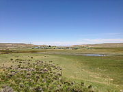
 Source of the Humboldt River in Wells
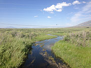 The Humboldt River near Deeth
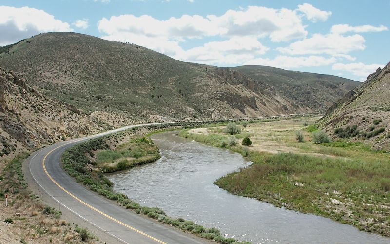
 The Humboldt flows through the Rye Patch Reservoir
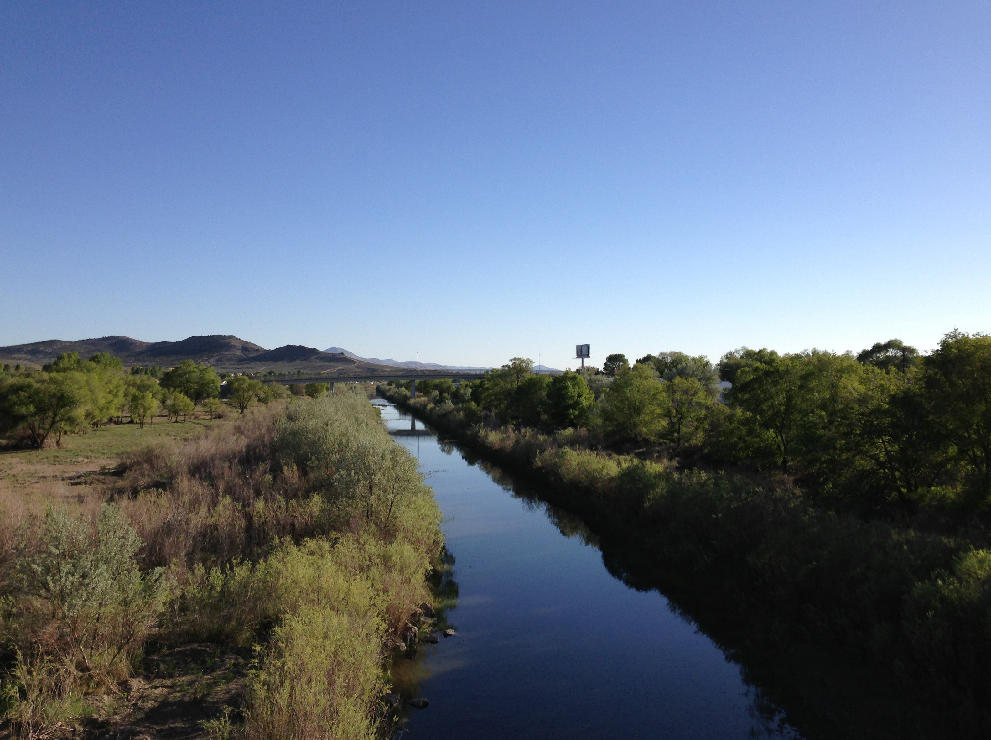
 Humboldt River near Lovelock
geo.wikisort.org - River
The Humboldt River is an extensive river drainage system located in north-central Nevada. It extends in a general east-to-west direction from its headwaters in the Jarbidge, Independence, and Ruby Mountains in Elko County, to its terminus in the Humboldt Sink, approximately 225 direct miles away in northwest Churchill County.[4] Most estimates put the Humboldt River at 300 miles (480 km) to 330 miles (530 km) long[5][6] however, due to the extensive meandering nature of the river, its length may be more closely estimated at 380 miles (612 km).[7] It is located within the Great Basin Watershed and is the third longest river in the watershed behind the Bear River at 355 miles (570 km) and the Sevier River at 325 miles (523 km). The Humboldt River Basin is the largest sub-basin of the Great Basin encompassing an area of 16,840 square miles (43,615 km2).[4] It is the only major river system wholly contained within the state of Nevada.
| Humboldt River | |
|---|---|
 The Humboldt River, flowing through Carlin Canyon | |
 Map of the Humboldt River watershed | |
| Etymology | Alexander von Humboldt |
| Location | |
| Country | United States |
| State | Nevada |
| Physical characteristics | |
| Source | Humboldt Wells |
| • location | East Humboldt Range, Elko County, Nevada |
| • coordinates | 41°7′13″N 114°58′5″W[1] |
| • elevation | 5,620 ft (1,710 m)[1] |
| Mouth | Humboldt Sink |
• location | Churchill County, Nevada |
• coordinates | 39°59′17″N 118°36′4″W[1] |
• elevation | 3,894 ft (1,187 m)[1] |
| Length | 290 mi (470 km) |
| Basin size | 16,680 sq mi (43,200 km2) |
| Discharge | |
| • average | 390 cu ft/s (11 m3/s)[2] |
| • minimum | 0 cu ft/s (0 m3/s) |
| • maximum | 17,000 cu ft/s (480 m3/s) |
Nevada Historical Marker | |
| Reference no. | 22[3] |
It is the only natural transportation artery across the Great Basin and has historically provided a route for westward migration. Additionally, two major railroad routes loosely follow its path. Interstate 80 follows the river's course from its source to its mouth. The river is named for the German naturalist Alexander von Humboldt.[8][9]
History
The region of the river in northern Nevada was sparsely inhabited by Numic-speaking people at the time of the arrival of European American settlers.[10] The region was little known by non-indigenous peoples until the arrival of fur trappers in the early 19th century.
The first recorded sighting of the river was on November 9, 1828, by Peter Skene Ogden of the Hudson's Bay Company, during his fifth expedition to the Snake Country. Odgen came southward along the Little Humboldt, encountering the main river at the confluence near Winnemucca. Ogden explored the river for several hundred miles, blazing a trail along it and making the first known map of the region. He initially named the river "Unknown River", due to the source and course of the river still unknown to him, and later "Paul's River", after one of his trappers who died on the expedition and was buried on the river bank.[11][12] He later changed it again to "Mary's River," named after the Native American wife of one of his trappers, which later somehow became "St. Mary's River". However, in 1829 he suggested that "Swampy River" best described the course he had traversed.[13] In 1833 the Bonneville–Walker fur party explored the river, naming it "Barren River". Washington Irving's 1837 book describing the Bonneville expedition called it "Ogden's River", the name used by many early travelers. By the early 1840s, the trail along the river was being used by settlers going west to California. The river provided drinkable water to earlier travelers on foot, but later emigrants using wagons required the significant riparian vegetation along its length as forage for their draft animals.

Palisades Canyon and the Humboldt River in 1868, during construction of the Transcontinental Railroad (LOC)

The same site, located just northeast of Palisade, 140 years later
In 1841 the river (then known as Mary's River) first became the route of the California Trail with the Bartleson–Bidwell Party, later becoming the primary land route for migrants to the California gold fields. In 1845 the river was explored by John C. Frémont, who made a thorough map of the region and gave the river its current name. In 1869 the river was used as part of the route of the Central Pacific segment of the Transcontinental Railroad.[3]
In the 20th century, the valley of the river became the route for U.S. Route 40, later replaced by Interstate 80.[14] In the latter part of the 20th century, about 45,000 people lived within 10 miles (16 km) of the river, roughly a third of the population at that time of the State of Nevada outside of Western Nevada and Southern Nevada, before the rapid 21st-century growth of Southern Nevada changed these population figures.
Watershed and course

The Humboldt River can be divided geographically into the upper, middle, and lower divisions based on Palisade Canyon and Emigrant Canyon being the major constriction points along the Humboldt River Valley. The upper basin begins in northeastern Nevada and drains about 5,000 square miles (13,000 km2) upstream from Palisade. The middle basin has a drainage area of about 7,800 square miles (20,000 km2) and lies between Palisade and Emigrant Canyon, a narrow gap located just downstream from Comus. The lower basin is an area encompassing some 4,100 square miles (11,000 km2) from below Emigrant Canyon and extending through the Humboldt Sink in northwestern Nevada.[14]
A hydrologic definition instead divides the Humboldt River drainage into two basins—one above and one below Palisade—based on flows that increase above and decrease below this part of the river. The river in the upper basin is 92 miles (148 km) long and in the lower basin it is 218 miles (351 km) long. The major tributaries of the upper Humboldt River basin are (heading downstream) Bishop Creek, Marys River,[15] Lamoille Creek, North Fork Humboldt River, South Fork Humboldt River, Susie Creek,[16] Maggie Creek,[17] and Marys Creek; and of the lower basin they are Pine Creek, Reese River, and the Little Humboldt River.[14]
The source of the main stem of the river is a spring called Humboldt Wells at the northern tip of the East Humboldt Range, just outside the city of Wells. The river flows west-southwest through Elko County past the communities of Elko and Carlin. Approximately 15 miles (24 km) upstream from Elko, the river receives the North Fork of the Humboldt River and receives the South Fork approximately 7 miles (11 km) downstream of Elko.
In northern Eureka County it passes through Palisade Canyon between the south end of the Tuscarora Mountains and the north end of the Shoshone Range. At Battle Mountain the river turns northwest for approximately 50 miles (80 km), then west at Red House and past Golconda and a spur of the Sonoma Range. It merges with the Reese River near Battle Mountain and receives the Little Humboldt River approximately 5 miles (8 km) upstream from Winnemucca.
Past the junction with the Little Humboldt, the river turns southwest, flowing past Winnemucca and through Pershing County, along the western side of the Humboldt Range and the West Humboldt Range.[14] In central Pershing County, the Rye Patch Dam impounds the river, forming the Rye Patch Reservoir, which stores water to irrigate farms near Lovelock, 22 miles (35 km) downstream.[18] The Humboldt empties into an intermittent lake in the Humboldt Sink on the border between Pershing and Churchill counties, approximately 20 miles (32 km) southwest of Lovelock.[19]
The river gains most of its water from snowmelt in the mountains in the eastern part of the watershed, most importantly the Ruby Mountains, Jarbidge Mountains, and Independence Mountains. River flow generally decreases downstream to the west, partly due to water removal from the river for irrigation, especially near Lovelock. Stream-gauge measurements undertaken by the United States Geological Survey suggest that Palisade Canyon, between Carlin and Beowawe, is the point where the river's flow ceases to increase and begins to decrease. Also, since the Humboldt's water comes almost exclusively from snowmelt, its flow is highly variable from season to season (peak flow occurs during the spring melt) and from year to year (depending on the amount of snow every winter)[2][14]


Ecology
The Lahontan cutthroat trout (Oncorhynchus clarki henshawi) is an inland subspecies of cutthroat trout endemic to northern Nevada, eastern California, and southern Oregon. In 1970 the U.S. Fish and Wildlife Service (USFWS) listed the Lahontan cutthroat trout (LCT) as “endangered”. In 1975 it reclassified LCT as “threatened” to facilitate management and to allow regulated fishing. Genetic and meristic studies of LCT indicate that the Humboldt River Basin LCT is a unique subspecies of cutthroat trout.[20]
North American beaver (Castor canadensis) seem to have been making a comeback in Elko County possibly due to less fur trapping combined with reduced consumption of riparian willow and other vegetation by cattle. Maggie and Susie Creeks, which enter the Humboldt River near Carlin, have benefited from 20 years of work by ranchers, agencies, mines, and non-profit groups via improvements in grazing techniques and specific projects. A remote sensing project found 107 beaver dams along 20 miles (32 km) of Maggie Creek in 2006, which rose to 271 dams in 2010. Beaver dams are accelerating the recovery of riparian vegetation and widening the riparian zone as they slow the water and collect sediment that used to be lost downstream. In five years, beaver ponds have increased the amount of impounded water on Maggie Creek from 9 miles (14 km) of the stream to 16 miles (26 km). The impounded water is seeping into the ground and raising the water table. Newmont's shallow groundwater monitoring wells along Maggie Creek have shown about a 2-foot (0.6 m) rise over the past 17 years along Maggie Creek. Stream flows are more perennial, making more water available for wildlife and livestock and protecting populations of native trout.[21] Maggie Creek has a Beaver Creek tributary which flows from Beaver Peak in the Tuscarora Mountains.[22][23][24]
Environmental Aspects
The Humboldt River and its surrounding areas have raised some concern about the increasing levels of toxic elements such as arsenic and mercury. These elements are showing up in fish and other wildlife that consume the water. The quantity being absorbed by fish specifically is not of concerning levels though. Brumbaugh and May took samples of fish from the south fork of the Humboldt River. They determined mercury levels within the fish were between 0.061 and 0.082 micrograms per gram of flesh.[25] This is well below the EPA's guideline of 0.30 micrograms per gram.
See also
- List of Nevada rivers
- Sarah Winnemucca
References
- "Humboldt River". Geographic Names Information System. United States Geological Survey. 1980-11-28. Retrieved 2014-08-25.
- "USGS Gage#10336000 on the Humboldt River near Lovelock". National Water Information System. United States Geological Survey. 1913–2000. Retrieved 2010-02-25.
- Nevada Historical Marker 22 Nevada State Historic Preservation Office. 2010. Retrieved 2014-08-25
- "Humboldt River Chronology" (PDF). Nevada Division of Water.
- "Science in the Humboldt River Basin | U.S. Geological Survey".
- http://water.nv.gov/mapping/chronologies/humboldt/hrc-pt1.pdf [bare URL PDF]
- ARMY ENGINEER DISTRICT SACRAMENTO CA (1988-01-01). "American River Watershed Investigation, California. Reconnaisance [sic] Report". Fort Belvoir, VA. doi:10.21236/ada436430.
{{cite journal}}: Cite journal requires|journal=(help) - Gannett, Henry (1905). The Origin of Certain Place Names in the United States (2nd ed.). Washington, D.C.: Government Printing Office. p. 163. OCLC 249566017. Retrieved 2014-08-25.
- Federal Writers' Project (1941). Origin of Place Names: Nevada (PDF). W.P.A. p. 11.
- Shiozawa, Dennis K.; Rader, Russell B. (2005). Benke, Arthur C.; Cushing, Colbert E. (eds.). Rivers of North America: Chapter 14: Great Basin Rivers. Burlington, Massachusetts: Elsevier. p. 673. ISBN 0-12-088253-1.
- Scrugham, James C. (1935). "The Hudson's Bay Company in Nevada, from Nevada: The Narrative of the Conquest of a Frontier Land, vol. I, pp. 39-44]". The Nevada Observer. Archived from the original (reprint, 2006-12-09) on 2010-12-20. Retrieved 2010-12-30.
- Ogden, Peter Skene (copied by Laut, Agnes C., in 1905) (1829). "Journal of Peter Skene Ogden; Snake Expedition, 1828-1829". American Mountain Men. Retrieved 2014-08-25.
{{cite web}}: CS1 maint: multiple names: authors list (link) - McMullen, Wallace (2001). Names New and Old. Lewiston, New York: Edwin Mellen Press. p. 87. ISBN 0-7734-7534-6.
- Horton, Gary A. (2000). Humboldt River Chronology: An Overview (PDF). Carson City, Nevada: Nevada Division of Water Planning. Retrieved 2014-08-25.
- "Marys River". Geographic Names Information System. United States Geological Survey. 1980-12-12. Retrieved 2014-08-25.
- "Susie Creek". Geographic Names Information System. United States Geological Survey. 1980-12-12. Retrieved 2014-08-25.
- "Maggie Creek". Geographic Names Information System. United States Geological Survey. 1980-12-12. Retrieved 2014-08-25.
- Autobee, Robert. "Humboldt Project". Bureau of Reclamation. Archived from the original on 2013-03-16. Retrieved 2012-06-05.
- Nevada Road & Recreation Atlas (Map) (2nd ed.). Medford, Oregon: Benchmark Maps. 2007. pp. 47, 48. ISBN 0-929591-95-X.
- Trotter, Patrick C.; Behnke, Robert J. (March 2008). "The Case for Humboldtensis: A Subspecies Name for The Indigenous Cutthroat Trout (Oncorhynchus clarkii) of the Humboldt River, Upper Quinn River, and Coyote Basin Drainages, Nevada and Oregon". Western North American Naturalist. 68 (1): 58–65. doi:10.3398/1527-0904(2008)68[58:TCFHAS]2.0.CO;2. S2CID 84316986.
- Hyslop, Larry (2013-01-04). "Nature Notes: Beavers Working for Us". Elko Daily Press. Retrieved 2013-01-27.
- "Beaver Creek". Geographic Names Information System. United States Geological Survey, United States Department of the Interior.
- "Beaver Peak". Geographic Names Information System. United States Geological Survey, United States Department of the Interior.
- Maggie and Susie Creek Fish Barriers (PDF) (Report). Bureau of Land Management, Elko District. November 2011. Archived from the original (PDF) on 2015-09-23. Retrieved 2014-10-21.
- May, Thomas W.; Brumbaugh, William G. (2007). Determination of Total Mercury in Whole-Body Fish and Fish Muscle Plugs Collected from the South Fork of the Humboldt River, Nevada, September 2005. Reston, Va: U.S. Geological Survey.
Further reading
- Wallace, A.R. et al. (2005). Metallic mineral resource assessment of the Humboldt River Basin, northern Nevada (USGS Fact Sheet 2005-3023]. Reno, NV: U.S. Department of the Interior, U.S. Geological Survey.
- Yager, D.B. and H.W. Folger. (2003). Map showing silver concentrations from stream sediments and soils throughout the Humboldt River Basin and surrounding areas, northern Nevada [U.S. Geological Survey Miscellaneous Field Studies Map MF-2407-I]. Denver, CO: U.S. Department of the Interior, U.S. Geological Survey.
External links
 Media related to Humboldt River at Wikimedia Commons
Authority control | |
|---|---|
| National libraries | |
| Other |
|
На других языках
[de] Humboldt River
Der Humboldt River (dt. „Humboldtfluss“, benannt nach dem Naturforscher Alexander von Humboldt) ist ein 483 km langer Fluss im US-amerikanischen Bundesstaat Nevada. Der Humboldt River wird aus einem östlichen und nördlichen Zulauf bei Elko County im Nordosten von Nevada gebildet. Die Hauptzuflüsse kommen aus den Ruby Mountains, Jarbidge Mountains, Independence Mountains und dem östlichen Humboldtgebirge. Er verläuft in westlicher Richtung am Nordrand der Wüste des Großen Beckens. Der Fluss ergießt sich schließlich in die flachen Becken der Humboldt Sink. Diese Seen haben keinen Abfluss. Das Wasser verdunstet unter den klimatischen Bedingungen der Wüstenregion. Auf großen Teilen seines Laufs wird er von den Schienen der Central Pacific Railroad und dem Interstate-Highway 80 begleitet.- [en] Humboldt River
[es] Río Humboldt
El río Humboldt (en inglés: Humboldt River) es un río del Oeste de Estados Unidos que discurre íntegramente por el estado de Nevada, en una zona poco poblada de su parte norte. Es un largo río endorreico perteneciente a la región de la Gran Cuenca que desagua en el Humboldt Sink, y que con sus afluentes, irriga la mayor parte del norte de Nevada, atravesándolo de este a oeste discurriendo a través de una sucesión de hendiduras en las cordilleras de la región, que discurren en dirección N-S. Administrativamente, discurre por los condados de Elko, Eureka, Lander, Humboldt, Pershing y Churchill.[it] Humboldt (fiume)
Il fiume Humboldt scorre nel Nevada settentrionale, negli Stati Uniti occidentali. Con i suoi 530 km, è il secondo fiume per lunghezza del Gran Bacino dopo il fiume Bear, nello Utah. Non sfocia in mare, ma le sue acque alimentano il Lago Humboldt, nell'Humboldt Sink.[ru] Гумбольдт (река)
Гу́мбольдт (англ. Humboldt River[1]) — река в северной части штата Невада, США. Длина реки составляет 531 км, что делает её второй самой длинной рекой Большого Бассейна после реки Бэр. Названа в честь немецкого натуралиста и путешественника Александра фон Гумбольдта. Расход воды — 11 м³/с[2].Текст в блоке "Читать" взят с сайта "Википедия" и доступен по лицензии Creative Commons Attribution-ShareAlike; в отдельных случаях могут действовать дополнительные условия.
Другой контент может иметь иную лицензию. Перед использованием материалов сайта WikiSort.org внимательно изучите правила лицензирования конкретных элементов наполнения сайта.
Другой контент может иметь иную лицензию. Перед использованием материалов сайта WikiSort.org внимательно изучите правила лицензирования конкретных элементов наполнения сайта.
2019-2026
WikiSort.org - проект по пересортировке и дополнению контента Википедии
WikiSort.org - проект по пересортировке и дополнению контента Википедии