geo.wikisort.org - River
Hall Run is a 1.75 mi (2.82 km) long 1st order tributary to Orrs Run in Ohio County, West Virginia.
| Hall Run Tributary to Orrs Run | |
|---|---|
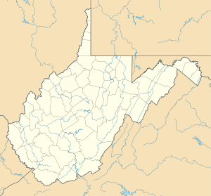 Location of Hall Run mouth  Hall Run (Orrs Run tributary) (the United States) | |
| Location | |
| Country | United States |
| State | West Virginia |
| County | Ohio |
| Physical characteristics | |
| Source | Little Wheeling Creek divide |
| • location | about 1 mile south-southeast of Valley Grove, West Virginia |
| • coordinates | 40°04′41″N 080°33′46″W[1] |
| • elevation | 1,250 ft (380 m)[2] |
| Mouth | Orrs Run |
• location | about 1.5 miles east-northeast of Camp Giscowhego, West Virginia |
• coordinates | 40°03′17″N 080°33′20″W[1] |
• elevation | 994 ft (303 m)[3] |
| Length | 1.75 mi (2.82 km)[4] |
| Basin size | 0.98 square miles (2.5 km2)[5] |
| Discharge | |
| • location | Orrs Run |
| • average | 1.31 cu ft/s (0.037 m3/s) at mouth with Orrs Run[5] |
| Basin features | |
| Progression | Orrs Run → Middle Wheeling Creek → Little Wheeling Creek → Wheeling Creek → Ohio River → Mississippi River → Gulf of Mexico |
| River system | Ohio River |
| Tributaries | |
| • left | unnamed tributaries |
| • right | unnamed tributaries |
| Bridges | Hi Park, I-70, Technology Drive, Sample Road |
Course
Hall Run rises about 2 miles south-southeast of Valley Grove, West Virginia, and then flows southerly to join Orrs Run about 1.5 miles east-northeast of Camp Giscowhego.[3]
Watershed
Hall Run drains 0.98 square miles (2.5 km2) of area, receives about 41.0 in/year of precipitation, has a wetness index of 310.68, and is about 44% forested.[5]
See also
References
- "GNIS Detail - Hall Run". geonames.usgs.gov. US Geological Survey. Retrieved 30 June 2021.
- "Get Maps". USGS Topoview. US Geological Survey. Retrieved 30 June 2021.
- "Get Maps". USGS Topoview. US Geological Survey. Retrieved 30 June 2021.
- "ArcGIS Web Application". epa.maps.arcgis.com. US EPA. Retrieved 30 June 2021.
- "Hall Run Watershed Report". US EPA Geoviewer. US EPA. Retrieved 30 June 2021.
Текст в блоке "Читать" взят с сайта "Википедия" и доступен по лицензии Creative Commons Attribution-ShareAlike; в отдельных случаях могут действовать дополнительные условия.
Другой контент может иметь иную лицензию. Перед использованием материалов сайта WikiSort.org внимательно изучите правила лицензирования конкретных элементов наполнения сайта.
Другой контент может иметь иную лицензию. Перед использованием материалов сайта WikiSort.org внимательно изучите правила лицензирования конкретных элементов наполнения сайта.
2019-2026
WikiSort.org - проект по пересортировке и дополнению контента Википедии
WikiSort.org - проект по пересортировке и дополнению контента Википедии