geo.wikisort.org - River
Great Ditch is a drainage ditch that drains areas of the Pigeon Swamp State Park in New Jersey in the United States.
| Great Ditch | |
|---|---|
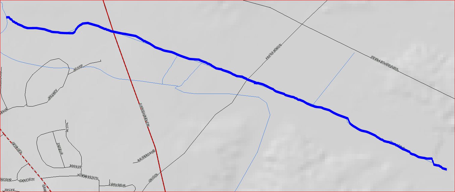 Great Ditch map | |
| Location | |
| Country | United States |
| Physical characteristics | |
| Source | |
| • coordinates | 40°23′5″N 74°28′57″W |
| • elevation | 89 ft (27 m) |
| Mouth | |
• coordinates | 40°23′39″N 74°30′27″W |
| Basin features | |
| Progression | Lawrence Brook, Raritan River, Atlantic Ocean |
| River system | Raritan River system |
Course
Great Ditch starts at 40°23′5″N 74°28′57″W,[1] in the Pigeon Swamp State Park. It flows west, crossing Fresh Ponds Road and Route 130 before joining another stream at 40°23′39″N 74°30′27″W[1] which drains into the Lawrence Brook.
Purpose
This canal's purpose is to drain sections of the Pigeon Swamp to prevent flooding of Deans Rhode Hall Road, which passes through the swamp.
Sister tributaries
- Beaverdam Brook
- Ireland Brook
- Oakeys Brook
- Sawmill Brook
- Sucker Brook
- Terhune Run
- Unnamed Brook in Rutgers Gardens, unofficially named Doc Brook
- Unnamed Brook in Rutgers' Helyar Woods
See also
References
- "Great Ditch". Geographic Names Information System. United States Geological Survey. Retrieved 2010-07-24.
External links
Текст в блоке "Читать" взят с сайта "Википедия" и доступен по лицензии Creative Commons Attribution-ShareAlike; в отдельных случаях могут действовать дополнительные условия.
Другой контент может иметь иную лицензию. Перед использованием материалов сайта WikiSort.org внимательно изучите правила лицензирования конкретных элементов наполнения сайта.
Другой контент может иметь иную лицензию. Перед использованием материалов сайта WikiSort.org внимательно изучите правила лицензирования конкретных элементов наполнения сайта.
2019-2026
WikiSort.org - проект по пересортировке и дополнению контента Википедии
WikiSort.org - проект по пересортировке и дополнению контента Википедии