geo.wikisort.org - River
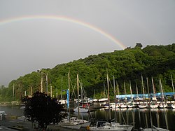
The Gouët (Ar Goued in the breton language) is a French river, located in the department of Côtes-d'Armor, in the region of Brittany, which drains into the English Channel.
| Gouët | |
|---|---|
 Gouët | |
| Native name | Le Gouët (French) |
| Location | |
| Country | France |
| Physical characteristics | |
| Mouth | |
• location | English Channel |
| Length | 46.6 km (29.0 mi) |
| Basin size | 240 km2 (93 sq mi) |
| Discharge | |
| • average | 2.042 m3/s (72.1 cu ft/s) |
Geography
The river's source is found at the top of Kerchouan, a shale geological feature located in the commune of La Harmoye. Il prend sa source à la cime de Kerchouan, un relief schisteux situé sur la commune de La Harmoye. Much of the water is from rainfall, however, it is also influenced by a dam in La Méaugon, which collects potable water for the nearby city of Saint-Brieuc. This dam siphons off 86% of the surface of the basin.
The Gouët is an extremely polluted river. Its banks are the site of intensive agriculture, and in addition it receives runoff from multiple nearby oil refineries. Finally, the Gouët is polluted by the waste products from nearby food processing factories.
The river is 46.6 km (29.0 mi) long [1] and it empties into the English Channel at Saint-Brieuc, at the port of Légué, thus separating the cities of Saint-Brieuc and Plérin. The width varies between 10 and 23 feet (3 and 7m). The average discharge measured between 1990 and 1997 was 2.042 m3/s (72.1 cu ft/s), with measured discharges of 12 m3/s (420 cu ft/s) during strong winter floods.
The drainage basin has an area of 251 km2 (97 sq mi)[1] and the underlying rock is primarily granite.
Tributaries
- The Gouédic, which empties into the river at Légué.
Towns
Quintin, Ploufragan, Saint-Brieuc, Plérin
See also
- Rivers of France
Notes and references
На других языках
[de] Gouët
Der Gouët (bretonisch: Ar Goued) ist ein Küstenfluss in Frankreich, der im Département Côtes-d’Armor in der Region Bretagne verläuft. Er entspringt im nördlichen Gemeindegebiet von Le Haut-Corlay, entwässert generell in nordöstlicher Richtung und mündet nach rund 47[3] Kilometern an der Gemeindegrenze von Saint-Brieuc und Plérin in der Baie de Saint-Brieuc in den Ärmelkanal. Im Mündungsabschnitt kann der Fluss bis zum Sportboothafen Port du Légué befahren werden.- [en] Gouët
[es] Río Gouët
El río Gouët (en bretón Ar Goued) es un río de Bretaña (Francia). Nace a unos 300 msnm en la Cime de Kerchouan, en la comuna de Harmoye. Desemboca en el canal de la Mancha en el puerto de Le Légué, separando los municipios de Saint Brieuc y Plérin. Su longitud es de 38 km. Su cuenca tiene una extensión de 240 km².Другой контент может иметь иную лицензию. Перед использованием материалов сайта WikiSort.org внимательно изучите правила лицензирования конкретных элементов наполнения сайта.
WikiSort.org - проект по пересортировке и дополнению контента Википедии

