geo.wikisort.org - River
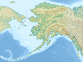
The Glacier River is a river 12 miles (19 km) southwest of Whittier near the Kenai Peninsula in Alaska.[1] It rises in a remote valley from a glacial meltwater lake from Twentymile glacier and flows out into a large, wide valley where it receives the water of the Carmen River. The river ends abruptly after 6.5 miles (10.5 km) as it is joined by the Twentymile River.[2] It was named by Captain E. F. Glenn in 1898.[3]
| Glacier River | |
|---|---|
 | |
| Location | |
| Country | United States |
| State | Alaska |
| City | Anchorage |
| Physical characteristics | |
| Source | Twentymile Glacier |
| Mouth | Twentymile River |
• location | Near Portage |
• coordinates | 60°53′43″N 148°54′33″W |
• elevation | 33 m (108 ft) |
| Length | 6.5 mi (10.5 km) |
| Discharge | |
| • location | mouth |
| Basin features | |
| Tributaries | |
| • left | Carmen River |
References
- "Alaska Topographic Maps by Topo Zone". TopoZone. Retrieved 2018-02-20.
- "Glacier River".
- Orth, Donald J. (1967). Dictionary of Alaska Place Names. U.S. Government Printing Office. p. 997.
usgs glacier river naming.
Текст в блоке "Читать" взят с сайта "Википедия" и доступен по лицензии Creative Commons Attribution-ShareAlike; в отдельных случаях могут действовать дополнительные условия.
Другой контент может иметь иную лицензию. Перед использованием материалов сайта WikiSort.org внимательно изучите правила лицензирования конкретных элементов наполнения сайта.
Другой контент может иметь иную лицензию. Перед использованием материалов сайта WikiSort.org внимательно изучите правила лицензирования конкретных элементов наполнения сайта.
2019-2026
WikiSort.org - проект по пересортировке и дополнению контента Википедии
WikiSort.org - проект по пересортировке и дополнению контента Википедии