geo.wikisort.org - River
The Geul (Dutch pronunciation: [ˈɣøːl], Limburgish: [ˈʝøːl];[tone?] German: Göhl [ˈɡøːl]; French: la Gueule) is a river in Belgium and in the Netherlands, where it is a right-bank tributary to the river Meuse.
| Geul | |
|---|---|
 The Geul valley in Plombières, Belgium | |
 The Geul (Ge) in South Limburg, with tributaries Eyserbeek (E), Gulp (Gu) and Selzerbeek (Se). | |
| Location | |
| Country | Belgium, Netherlands |
| Physical characteristics | |
| Source | |
| • location | near Lichtenbusch |
| • elevation | ±300 m (980 ft) |
| Mouth | |
• location | Meuse near Bunde |
• coordinates | 50°53′49″N 5°43′4″E |
| Length | 58.0 km (36.0 mi) [1] |
| Basin features | |
| Progression | Meuse→ North Sea |
Geography
The source of the Geul is at about 300 metres (980 ft) above sea level in northeastern Belgium near the German border, south of the German town of Aachen. From there, after flowing some 20 kilometres (12 mi) in a northwestern direction, it leaves Belgium and enters the Netherlands at Cotessen in the Vaals municipality. After a further 38 kilometres (24 mi) in a west-northwestern direction through the most southern part of Limburg, which in its turn is the most southern province of the Netherlands, it flows into the Meuse, north of the city of Maastricht.
A tributary of the Geul is the Gulp.
Places through which the Geul passes are among others Kelmis (Belgium), Valkenburg aan de Geul and Meerssen (Netherlands).
Pollution
The water of the Geul is polluted seriously with heavy metals zinc and lead and as a result also is a serious source of heavy metal inflow into the Meuse.
This pollution is a result of former zinc and lead mining activities near the Belgian towns of Kelmis (La Calamine) and Plombières (formerly named Bleiberg).
The last one of these mines have closed early in the 20th century. One of the reasons for giving up mining activities in Plombières was the occasional flooding of the mine by the Geul, as the bedrock (mainly Carboniferous limestone) contains many faults and fissures.
Although mine factory buildings have been demolished, old railway dikes still are abundantly present in the area. They provide ideal hiking routes, that are known for the presence of so-called "zinc flora" (zinc-tolerant plants, such as yellow calamine violet and Viola calaminaria).
Significant events

During the 2021 European floods, the banks of the river flooded, including in some of the major population centers such as Valkenburg aan de Geul.[2]
Gallery
 At Kelmis Tueljebach
 At Schin op Geul
 At Strabeek
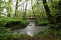
 Estuary at Voulwammes


References
| Authority control |
|
|---|
На других языках
[de] Göhl (Fluss)
Die Göhl (niederländisch Geul, französisch Gueule) ist ein Fluss in Belgien und den Niederlanden.- [en] Geul
[it] Geul
Il Geul è un fiume che scorre tra Belgio e Paesi Bassi, dove si immette nella Mosa.Другой контент может иметь иную лицензию. Перед использованием материалов сайта WikiSort.org внимательно изучите правила лицензирования конкретных элементов наполнения сайта.
WikiSort.org - проект по пересортировке и дополнению контента Википедии