geo.wikisort.org - River
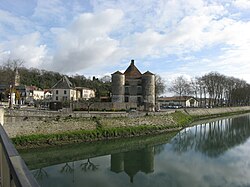
The Gaves réunis (French pronunciation: [ɡav ʁeyni]) is a 9.4 km river in southwestern France connecting Peyrehorade to the Adour at Bec du Gave.[1] It is formed by the confluence of the Gave de Pau and the Gave d'Oloron. It is navigable for 8 km from the confluence with the Adour until the town Peyrehorade.[2]
| Gaves réunis | |
|---|---|
 | |
| Location | |
| Country | France |
| Physical characteristics | |
| Source | |
| • location | Peyrehorade |
| Mouth | |
• location | Adour |
• coordinates | 43°32′46″N 1°11′41″W |
| Length | 9.4 km (5.8 mi) |
| Basin size | 5,200 km2 (2,000 sq mi) |
| Discharge | |
| • average | 188 m3/s (6,600 cu ft/s) |
| Basin features | |
| Progression | Adour→ Atlantic Ocean |
See also
References
- McKnight, Hugh (2005). Cruising French Waterways, 4th Edition. Sheridan House. ISBN 9781574092103.
- Fluviacarte, Gaves réunis
На других языках
[de] Gaves Réunis
Der Fluss Gaves Réunis verläuft in Frankreich, im Département Landes, in der Region Nouvelle-Aquitaine. Er entsteht durch die Vereinigung der beiden Flüsse Gave de Pau und Gave d’Oloron, knapp oberhalb der Stadt Peyrehorade. Unter diesem neuen Namen fließt er rund 10[2] Kilometer gegen Westen und mündet schließlich beim Château du Bec du Gave, zwischen den Gemeinden Port-de-Lanne und Sames, als linker Nebenfluss in den Adour.- [en] Gaves réunis
[it] Gaves réunis
Il Gaves réunis è un corso d'acqua formato dall'unione delle acque della gave de Pau con il gave d'Oloron, che percorre per 10 Km il dipartimento delle Landes fino al confine con quello dei Pirenei Atlantici, per poi confluire a sua volta nel fiume Adour.Текст в блоке "Читать" взят с сайта "Википедия" и доступен по лицензии Creative Commons Attribution-ShareAlike; в отдельных случаях могут действовать дополнительные условия.
Другой контент может иметь иную лицензию. Перед использованием материалов сайта WikiSort.org внимательно изучите правила лицензирования конкретных элементов наполнения сайта.
Другой контент может иметь иную лицензию. Перед использованием материалов сайта WikiSort.org внимательно изучите правила лицензирования конкретных элементов наполнения сайта.
2019-2025
WikiSort.org - проект по пересортировке и дополнению контента Википедии
WikiSort.org - проект по пересортировке и дополнению контента Википедии

