geo.wikisort.org - River
Garcitas Creek is a 48-mile (77 km) stream in Victoria County and Jackson County, Texas, in the United States. It flows to Garcitas Cove.[1]
| Garcitas Creek | |
|---|---|
 Garcitas Creek illustration ca. 1851 | |
  State of Texas 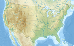 Garcitas Creek (the United States) | |
| Location | |
| Township | La Salle |
| Texas County | Jackson |
| Texas County | Victoria |
| U.S. State | Texas |
| Country | United States |
| Physical characteristics | |
| Source | Fordtran, Texas |
| • location | DeWitt County, Texas |
| • coordinates | 29.050000°N 97.083333°W |
| • elevation | 219 ft (67 m) |
| Mouth | Lavaca Bay |
• location | Victoria County, Texas |
• coordinates | 28.713927°N 96.659441°W |
• elevation | −.53 ft (−0.16 m) |
| Length | 48-mile (77 km) |
| Basin features | |
| Inland ports | Port Lavaca, Texas |
Garcitas is a name derived from Spanish meaning the fresh antlers of a deer.[2]
References
- U.S. Geological Survey Geographic Names Information System: Garcitas Creek
- Weisiger, Sidney R. (Apr 12, 1970). "Creeks in Victoria County". The Victoria Advocate. p. 10. Retrieved 3 May 2015.
External links
- Roell, Craig H. "Garcitas Creek". Handbook of Texas Online. Texas State Historical Association.
 | This article about a location in Jackson County, Texas is a stub. You can help Wikipedia by expanding it. |
 | This article about a location in Victoria County, Texas is a stub. You can help Wikipedia by expanding it. |
 | This article related to a river in Texas is a stub. You can help Wikipedia by expanding it. |
На других языках
- [en] Garcitas Creek
[it] Garcitas Creek
Il "Garcitas Creek" è un fiume del Texas.Текст в блоке "Читать" взят с сайта "Википедия" и доступен по лицензии Creative Commons Attribution-ShareAlike; в отдельных случаях могут действовать дополнительные условия.
Другой контент может иметь иную лицензию. Перед использованием материалов сайта WikiSort.org внимательно изучите правила лицензирования конкретных элементов наполнения сайта.
Другой контент может иметь иную лицензию. Перед использованием материалов сайта WikiSort.org внимательно изучите правила лицензирования конкретных элементов наполнения сайта.
2019-2026
WikiSort.org - проект по пересортировке и дополнению контента Википедии
WikiSort.org - проект по пересортировке и дополнению контента Википедии