geo.wikisort.org - River
The Fort River is a river in Western Massachusetts and is a tributary of the Connecticut River and runs through the towns of, Amherst, Massachusetts, and ends in Hadley, Massachusetts.[1]
This article includes a list of general references, but it lacks sufficient corresponding inline citations. (July 2018) |
| Fort River | |
|---|---|
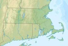 Location of the mouth of the Fort River within Massachusetts | |
| Location | |
| Country | United States |
| State | Massachusetts |
| County | Hampshire |
| Physical characteristics | |
| Source | Fort River at Adams Brook (location where Amythest Brook flows into Adams Brook) |
| • location | Pelham, Massachusetts |
| Mouth | |
• location | Hadley, Massachusetts |
• coordinates | 42.3261°N 72.5843°W |
The Fort technically begins as Adams Brook which begins at a pond near Atkin's Reservoir in Shutesbury, Massachusetts (however the ponds aren't part of the reservoir), and flows south-west ward until it reaches the spot where Amythest Brook flows into it, where it becomes the "Fort River." Although it has no dams or man-made things on the river, some of the Fort's tributaries have reservoirs.
The Fort River has a wide variety of wildlife due to it being the longest free-flowing tributary (having no dams or other man made changes made to the rivers shape or flow) of the Connecticut River. Because of this there is a lot of wildlife making it one of the 3 most diverse rivers in the state. Mussels, Eastern Pearlfish, Sea Lampreys, and American Eel's.[2]
References
External links
Другой контент может иметь иную лицензию. Перед использованием материалов сайта WikiSort.org внимательно изучите правила лицензирования конкретных элементов наполнения сайта.
WikiSort.org - проект по пересортировке и дополнению контента Википедии