geo.wikisort.org - River
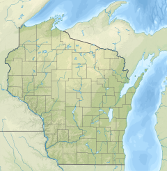
The Fond du Lac River is a river that flows through the city of Fond du Lac, Wisconsin into Lake Winnebago.[1] The river starts near Rosendale, Lamartine and Eldorado, then flows around 10 miles east. The east and west branches come together in downtown Fond du Lac less than a mile before flowing into Lake Winnebago.[2]
| Fond du Lac River | |
|---|---|
 The Fond du Lac River as it passes through the Town of Fond du Lac. | |
  | |
| Location | |
| Country | United States |
| State | Wisconsin |
| County | Fond du Lac |
| Physical characteristics | |
| Source | |
| • coordinates | 43.7811111°N 88.4580556°W |
| Mouth | Lake Winnebago |
• location | City of Fond du Lac |
• coordinates | 43.8005443°N 88.4526073°W |
• elevation | 751 feet (229 m) |
The Supple Marsh and Lakeside Park border the river as it flows into Lake Winnebago.
2019 Flooding
On March 13 and 14, the river flooded its banks in downtown Fond du Lac.[3] The flooding was a result of ice jams under the main bridges that cross the river in the city. Evacuation efforts were put in place, as crews worked to remove the ice. Multiple state and local groups helped with the recovery.
See also
- List of Wisconsin rivers
References
- "Report for Fond du Lac River". USGNIS. Retrieved April 13, 2018.
- "Fond du Lac River Watershed". Wisconsin DNR. Retrieved April 13, 2018.
- Roznik, Sharon. "Flooding intensifies in Fond du Lac as rush hour passes; more residents evacuated". The Fond du Lac Reporter. Retrieved 19 March 2019.
Текст в блоке "Читать" взят с сайта "Википедия" и доступен по лицензии Creative Commons Attribution-ShareAlike; в отдельных случаях могут действовать дополнительные условия.
Другой контент может иметь иную лицензию. Перед использованием материалов сайта WikiSort.org внимательно изучите правила лицензирования конкретных элементов наполнения сайта.
Другой контент может иметь иную лицензию. Перед использованием материалов сайта WikiSort.org внимательно изучите правила лицензирования конкретных элементов наполнения сайта.
2019-2026
WikiSort.org - проект по пересортировке и дополнению контента Википедии
WikiSort.org - проект по пересортировке и дополнению контента Википедии