geo.wikisort.org - River
Erlauf is a river of Lower Austria and of Styria, Austria.[1] Its drainage basin is 632 km2 (244 sq mi).[2]
| Erlauf | |
|---|---|
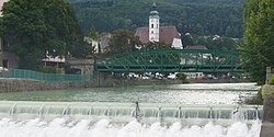
 The Erlauf at Scheibbs | |
| Location | |
| Country | Austria |
| States | Lower Austria and Styria |
| Physical characteristics | |
| Source | |
| • location | at the foot of the Gemeindealpe |
| • coordinates | 47.8076°N 15.2299°E |
| Mouth | |
• location | at Pöchlarn into the Danube |
• coordinates | 48.2134°N 15.1943°E |
| Basin size | 632 km2 (244 sq mi) |
| Basin features | |
| Progression | Danube→ Black Sea |
The Erlauf springs at the foot of the mountain Gemeindealpe[1][3] It is a right tributary of the Danube in Pöchlarn.[4]
References
Wikimedia Commons has media related to Erlauf (river).
- "Erlauf source and Gemeindealpe". Niederösterreich ATLAS. Retrieved 22 January 2020. (look for Erlaufursprung)
- "Flächenverzeichnis der Flussgebiete: Donaugebiet von der Enns bis zur Leitha" (PDF). Beiträge zur Hydrografie Österreichs Heft 62. December 2014. p. 49.
- Google (20 January 2020). "Erlach source" (Map). Google Maps. Google. Retrieved 20 January 2020.
- Google (20 January 2020). "Erlauf mouth" (Map). Google Maps. Google. Retrieved 20 January 2020.
На других языках
[de] Erlauf (Fluss)
Die Erlauf ist ein Nebenfluss der Donau im Bezirk Scheibbs und Bezirk Melk in Niederösterreich sowie teilweise auch in der Steiermark. Die Erlauf ist insgesamt etwa 70 km lang und mündet bei Pöchlarn in die Donau.- [en] Erlauf (river)
Текст в блоке "Читать" взят с сайта "Википедия" и доступен по лицензии Creative Commons Attribution-ShareAlike; в отдельных случаях могут действовать дополнительные условия.
Другой контент может иметь иную лицензию. Перед использованием материалов сайта WikiSort.org внимательно изучите правила лицензирования конкретных элементов наполнения сайта.
Другой контент может иметь иную лицензию. Перед использованием материалов сайта WikiSort.org внимательно изучите правила лицензирования конкретных элементов наполнения сайта.
2019-2025
WikiSort.org - проект по пересортировке и дополнению контента Википедии
WikiSort.org - проект по пересортировке и дополнению контента Википедии