geo.wikisort.org - River
Eira is a river in Molde Municipality in Møre og Romsdal county, Norway. The 7-kilometre (4.3 mi) long river flows from the lake Eikesdalsvatnet past the village of Eresfjord and into the Eresfjorden. The mountain Skjorta lies 5 kilometres (3.1 mi) east of the river.
| Eira | |
|---|---|
 Eira river in Eresfjord | |
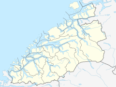 Location of the river  Eira (river) (Norway) | |
| Location | |
| Country | Norway |
| County | Møre og Romsdal |
| Municipalities | Molde Municipality |
| Physical characteristics | |
| Source | Eikesdalsvatnet |
| • location | Osen, Molde |
| • coordinates | 62.63159°N 8.10182°E |
| • elevation | 22 metres (72 ft) |
| Mouth | Eresfjorden |
• location | Syltebø, Molde |
• coordinates | 62.68495°N 8.13164°E |
• elevation | 0 metres (0 ft) |
| Length | 7 km (4.3 mi) |
Historically, the river was a bountiful salmon fishing area, but since it has become a regulated river for nearby hydro-electric power stations, the fish have not been as plentiful.[1]
See also
- List of rivers in Norway
References
- Store norske leksikon. "Eira" (in Norwegian). Retrieved 2010-10-31.
| Authority control |
|
|---|
This Møre og Romsdal location article is a stub. You can help Wikipedia by expanding it. |
This article related to a river in Norway is a stub. You can help Wikipedia by expanding it. |
На других языках
[de] Eira (Fluss)
Die Eira ist ein Fluss im norwegischen Fylke Møre og Romsdal.- [en] Eira (river)
Текст в блоке "Читать" взят с сайта "Википедия" и доступен по лицензии Creative Commons Attribution-ShareAlike; в отдельных случаях могут действовать дополнительные условия.
Другой контент может иметь иную лицензию. Перед использованием материалов сайта WikiSort.org внимательно изучите правила лицензирования конкретных элементов наполнения сайта.
Другой контент может иметь иную лицензию. Перед использованием материалов сайта WikiSort.org внимательно изучите правила лицензирования конкретных элементов наполнения сайта.
2019-2026
WikiSort.org - проект по пересортировке и дополнению контента Википедии
WikiSort.org - проект по пересортировке и дополнению контента Википедии