geo.wikisort.org - River
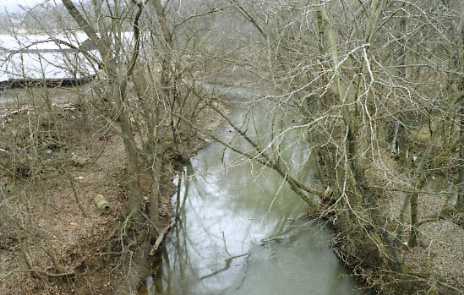
Duck Creek is a tributary of the Ohio River, approximately 30 mi (50 km) long, in southeastern Ohio in the United States. Via the Ohio River, it is part of the Mississippi River watershed. It drains an area of the Unglaciated Allegheny Plateau, between the watersheds of the Muskingum and Little Muskingum Rivers.
| Duck Creek | |
|---|---|
 | |
  | |
| Native name | Duck Creek (English) |
| Physical characteristics | |
| Source | |
| • coordinates | 39.5614624°N 81.4090088°W[1] |
| Mouth | |
• location | Marietta |
• coordinates | 39°24′18″N 81°25′38″W |

Course
Duck Creek is formed in the hill country of northern Washington County at the community of Warner, just west of Lower Salem and approximately 15 mi (24 km) north of Marietta, by the confluence of East Fork Duck Creek and West Fork Duck Creek. The East Fork, approximately 20 mi (30 km) long, rises in western Monroe County and flows generally southwardly through eastern Noble and northern Washington Counties. The West Fork, approximately 30 mi (50 km) long, rises in southeastern Guernsey County and flows generally south-southeastwardly through central Noble and northern Washington Counties, past the towns of Belle Valley, Caldwell, Dexter City and Macksburg; it is the larger of the two headwaters streams. From Warner, Duck Creek flows generally southwardly in a highly meandering course and joins the Ohio River at Marietta, about 3 mi (5 km) east of its downtown.
Flow rate
| Creek | Location | Time period | Annual mean discharge | Highest daily mean | Lowest daily mean |
|---|---|---|---|---|---|
| West Fork Duck Creek | USGS stream gauge at Macksburg | Water years 2012-2019 | 112.3 cu ft/s (3.18 m3/s) | 2,520 cu ft/s (71 m3/s) (April 4, 2018) | 0.68 cu ft/s (0.019 m3/s) (September 20, 2019)[2] |
| East Fork Duck Creek | USGS stream gauge near Harriettsville | Water years 2012-2019 | 148 cu ft/s (4.2 m3/s) | 4,220 cu ft/s (119 m3/s) (February 8, 2019) | 0.07 cu ft/s (0.0020 m3/s) (October 19, 2016)[3] |
| Duck Creek | USGS stream gauge downstream of Whipple | Water years 2012-2019 | 359.1 cu ft/s (10.17 m3/s) | 9,150 cu ft/s (259 m3/s) (April 4, 2018) | 1.21 cu ft/s (0.034 m3/s) (September 7 2018)[4] |
| Duck Creek | mouth (Marietta) | N/A | 303.07 cu ft/s (8.582 m3/s) (estimate)[5] | N/A | N/A |
See also
References
- U.S. Geological Survey Geographic Names Information System: Duck Creek (Ohio)
- "USGS Water-Year Summary for Site 03115712". waterdata.usgs.gov. Archived from the original on 2020-08-07. Retrieved 2020-08-07.
- "USGS Water-Year Summary for Site 03115644". waterdata.usgs.gov. Archived from the original on 2020-08-07. Retrieved 2020-08-07.
- "USGS Water-Year Summary for Site 03115786". waterdata.usgs.gov. Archived from the original on 2020-08-07. Retrieved 2020-08-07.
- "Watershed Report: Duck Creek". watersgeo.epa.gov. United States Environmental Protection Agency Office of Water. Archived from the original on 2020-12-27. Retrieved 2020-12-27.
На других языках
[de] Duck Creek (Ohio River)
Der Duck Creek (englisch für „Enten-Bach“) ist ein 48 km langer rechter Nebenfluss des Ohio River im östlichen US-Bundesstaat Ohio in den Vorbergen der Appalachen.- [en] Duck Creek (Ohio)
[ru] Дак-Крик
Дак-Крик (англ. Duck Creek) — река на юго-востоке штата Огайо, США. Приток реки Огайо. Длина составляет около 48 км.Другой контент может иметь иную лицензию. Перед использованием материалов сайта WikiSort.org внимательно изучите правила лицензирования конкретных элементов наполнения сайта.
WikiSort.org - проект по пересортировке и дополнению контента Википедии