geo.wikisort.org - River
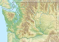
The Deschutes River is a 50-mile-long (80 km) river in the U.S. state of Washington. Its headwaters are in the Bald Hills in Lewis County, and it empties into Budd Inlet of Puget Sound at Olympia in Thurston County. It was given its name by French fur traders, who called it Rivière des Chutes, or "River of the Falls", a translation of the First Nations name for the site. (The city of Tumwater, founded in the same location, takes its name from the Chinook Jargon translation for "waterfall".)
| Deschutes River | |
|---|---|
 Tumwater Falls of the Deschutes River, in the city of Tumwater | |
| Location | |
| Country | United States |
| State | Washington |
| County | Thurston, Lewis |
| Physical characteristics | |
| Source | Cascade Range |
| • coordinates | 46°41′0″N 122°26′17″W[1] |
| Mouth | Puget Sound |
• coordinates | 47°1′6″N 122°54′13″W[1] |
| Length | 50 mi (80 km) |
| Basin size | 162 sq mi (420 km2)[2] |
| Discharge | |
| • location | river mile 2.4 at Tumwater[2] |
| • average | 396 cu ft/s (11.2 m3/s)[2] |
| • minimum | 48 cu ft/s (1.4 m3/s) |
| • maximum | 8,150 cu ft/s (231 m3/s) |
This article needs additional citations for verification. (November 2009) |
Tributaries of the river include Spurgeon Creek, Thurston Creek and Lake Lawrence.[3] There are numerous parks along its course, including Pioneer Park and Tumwater Falls Park. A popular tubing stretch runs from Pioneer Park to Tumwater Falls.
See also
- List of rivers of Washington
References
- U.S. Geological Survey Geographic Names Information System: Deschutes River
- "Water Resources Data-Washington Water Year 2005; Deschutes and Nisqually River Basins; 12080010 Deschutes River at E Street Bridge, at Tumwater, WA" (PDF). United States Geological Survey. Retrieved 2009-06-01.
- East Olympia, Vail, and Lake Lawrence, Washington 7.5 Minute Topographic Quadrangles, USGS, 1959
На других языках
- [en] Deschutes River (Washington)
[it] Deschutes River (Washington)
Il Deschutes River è un fiume con una lunghezza di 80 km (50 mi) nello Stato di Washington, Stati Uniti. La sua sorgente si trova nella Foresta Nazionale di Gifford Pinchot nella Contea di Lewis e sfocia in Budd Inlet, il braccio più meridionale dello Stretto di Puget presso Olympia nella Contea di Thurston. Ha preso il suo nome dai commercianti di pellicce francesi che lo chiamarono Rivière des Chutes, o "Fiume delle Cascate", una traduzione del nome nativo americano per il sito dato dalle Prime Nazioni. La città di Tumwater, fondata nella stessa località, prende il suo nome da un'altra traduzione per "cascata", in Chinook Jargon.Текст в блоке "Читать" взят с сайта "Википедия" и доступен по лицензии Creative Commons Attribution-ShareAlike; в отдельных случаях могут действовать дополнительные условия.
Другой контент может иметь иную лицензию. Перед использованием материалов сайта WikiSort.org внимательно изучите правила лицензирования конкретных элементов наполнения сайта.
Другой контент может иметь иную лицензию. Перед использованием материалов сайта WikiSort.org внимательно изучите правила лицензирования конкретных элементов наполнения сайта.
2019-2025
WikiSort.org - проект по пересортировке и дополнению контента Википедии
WikiSort.org - проект по пересортировке и дополнению контента Википедии

