geo.wikisort.org - River
Dadès River (Arabic: وادي دادس, wādī dādis; French: Oued Dadès; Amazigh: ⴰⵙⵉⴼ ⵏ ⴷⴰⴷⵙ) is a river in Morocco. It is a tributary of the Draa River.
This article needs additional citations for verification. (January 2021) |
| Dadès River | |
|---|---|
 Washing laundry on the banks of the Dades River in the Dades Gorge, Morocco. | |
 The headwaters of the Draa, with the Dades (top right to center) | |
| Location | |
| Country | Morocco |
| Physical characteristics | |
| Mouth | |
• coordinates | 31°00′09″N 6°31′36″W |
Geography
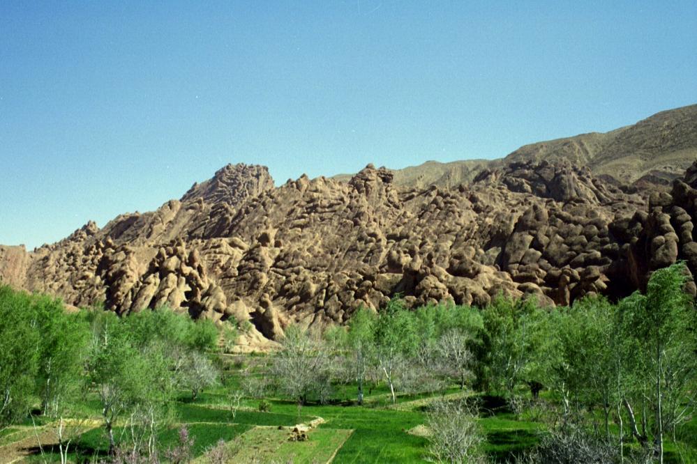
The Dadès River rises in the High Atlas and then turns south crossing through the Dadès Gorges, then westward between the High Atlas and Anti-Atlas mountain ranges. The river finally meets the Ouarzazate River, which then enters Draa River.
Dades Gorge is easily accessible by taxi from nearby Tinerhir. The scenery is significant with views of interesting rock formations. The valley itself is made lush and green by the river, while the surrounding area is rocky desert. There are simple communities still living here in traditional houses. Women can be seen washing laundry in the river and laying it to dry on the surrounding bushes.
Hydrology
Flow rate of the Dadès River is highly seasonal with peak flows in the January to April period following the high precipitation and ensuing snowmelt. The water quality is alkaline, and summer water temperatures are in the range of 23 to 28 degrees Celsius. Electrical conductivity of the water is relatively high.[1]
References
- C. Michael Hogan, Quality of Surface Waters in Morocco, Lumina Technologies, October, 2006
External links
| Wikimedia Commons has media related to Dadès river. |
Authority control | |
|---|---|
| General |
|
| National libraries | |
| Other |
|
На других языках
[de] Dades
Der Dades, auch Oued Dadès oder Assif Dadès (tamazight ⴰⵙⵙⵉⴼ ⵏ ⴷⴰⴷⵙⵙ) ist einer der wichtigsten Flüsse im südlichen Marokko.- [en] Dadès River
[it] Dades
Il Dades è un fiume del Marocco, sito alle coordinate .mw-parser-output .geo-default,.mw-parser-output .geo-dms,.mw-parser-output .geo-dec{display:inline}.mw-parser-output .geo-nondefault,.mw-parser-output .geo-multi-punct{display:none}.mw-parser-output .latitude,.mw-parser-output .longitude{white-space:nowrap}.mw-parser-output .geo{}body.skin-vector .mw-parser-output #coordinates{font-size:85%;line-height:1.5em;position:absolute;right:0;top:0;white-space:nowrap}31°00′09″N 6°31′36″W.Другой контент может иметь иную лицензию. Перед использованием материалов сайта WikiSort.org внимательно изучите правила лицензирования конкретных элементов наполнения сайта.
WikiSort.org - проект по пересортировке и дополнению контента Википедии