geo.wikisort.org - River
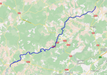
The Côney (French pronunciation: [konɛ]) is a 55.3-kilometre (34.4 mi) long river in the Vosges and Haute-Saône départements, northeastern France.[1] Its source is near Lion Faing, a lieu-dit in Dounoux. It flows generally southwest. It is a left tributary of the Saône into which it flows in Corre.
| Côney | |
|---|---|
 The Côney at Fontenoy-le-Château | |
 | |
| Location | |
| Country | France |
| Physical characteristics | |
| Source | |
| • location | Dounoux |
| • coordinates | 48°07′14″N 06°25′56″E |
| • elevation | 425 m (1,394 ft) |
| Mouth | |
• location | Saône |
• coordinates | 47°54′41″N 05°59′41″E |
• elevation | 220 m (720 ft) |
| Length | 55 km (34 mi) |
| Basin size | 317 km2 (122 sq mi) |
| Discharge | |
| • average | 5.29 m3/s (187 cu ft/s) |
| Basin features | |
| Progression | Saône→ Rhône→ Mediterranean Sea |
It shares its valley with the canal de l'Est on most of its course.
Départements and communes along its course
This list is ordered from source to mouth:
- Vosges: Dounoux, Uriménil, Uzemain, Xertigny, Charmois-l'Orgueilleux, La Chapelle-aux-Bois, Harsault, Les Voivres, Hautmougey, Bains-les-Bains, Fontenoy-le-Château, Le Magny, Montmotier,
- Haute-Saône: Ambiévillers, Mailleroncourt-Saint-Pancras, Pont-du-Bois, Alaincourt, Selles, La Basse-Vaivre, Passavant-la-Rochère, Demangevelle, Vougécourt, Corre,
References
Wikimedia Commons has media related to Côney.
This Vosges geographical article is a stub. You can help Wikipedia by expanding it. |
This Haute-Saône geographical article is a stub. You can help Wikipedia by expanding it. |
На других языках
[de] Côney
Der Côney ist der erste nennenswerte linke Nebenfluss der oberen Saône in Frankreich. Das Einzugsgebiet des rund 55 Kilometer langen Flusses beträgt 317 km².- [en] Côney
Текст в блоке "Читать" взят с сайта "Википедия" и доступен по лицензии Creative Commons Attribution-ShareAlike; в отдельных случаях могут действовать дополнительные условия.
Другой контент может иметь иную лицензию. Перед использованием материалов сайта WikiSort.org внимательно изучите правила лицензирования конкретных элементов наполнения сайта.
Другой контент может иметь иную лицензию. Перед использованием материалов сайта WikiSort.org внимательно изучите правила лицензирования конкретных элементов наполнения сайта.
2019-2026
WikiSort.org - проект по пересортировке и дополнению контента Википедии
WikiSort.org - проект по пересортировке и дополнению контента Википедии