geo.wikisort.org - River
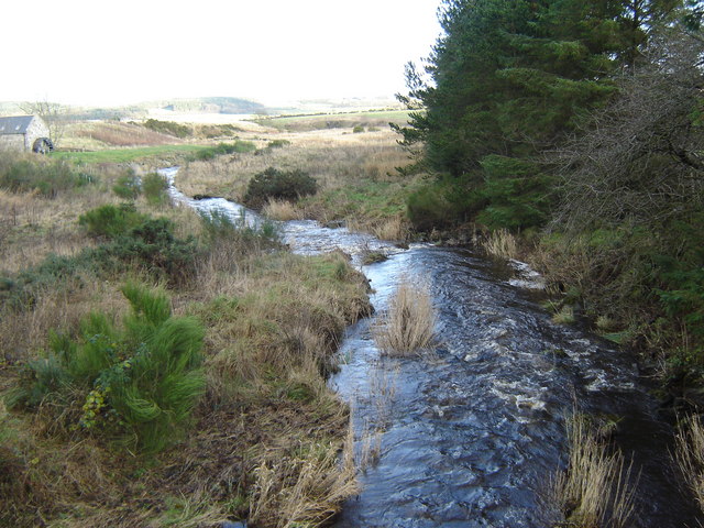
Crynoch Burn is a stream in Aberdeenshire that is tributary to the River Dee.[1] This stream rises somewhat above Netherley and flows near Netherley House; and thence into the Red Moss, a significant natural bog habitat; thence near the historic Lairhillock Inn; and finally by the village of Maryculter and through Oldman Wood before discharge to the Dee. Headwaters areas include the northern and western slopes of Meikle Carewe Hill and the northern slopes of Curlethney Hill.
| Crynoch Burn | |
|---|---|
 Crynoch Burn | |
| Location | |
| Country | Scotland |
| Physical characteristics | |
| Source | Nearby Netherley |
| Mouth | River Dee |
• coordinates | 57.09383°N 2.23660°W |
The soils near its mouth at the River Dee are light and sandy,[2] and the pH level of these greenish brown waters is approximately 8.05, or slightly alkaline
Hydrology
Tributaries to the Crynoch Burn include the Cairnie Burn. Classified in the Strahler Stream Order system the Crynoch Burn is a second order stream.
References
- John A. Henderson (1892) Annals of Lower Deeside: Being a Topographical, Proprietary, Ecclesiastical, and Antiquarian History of Durris, Drumoak, and Culter, D. Wyllie and Son, 271 pages
- Notes
- United Kingdom Ordnance Survey Map Landranger 45, Stonehaven and Banchory, 1:50,000 scale, 2004
- Historic profile of the village of Maryculter
This Aberdeenshire location article is a stub. You can help Wikipedia by expanding it. |
Другой контент может иметь иную лицензию. Перед использованием материалов сайта WikiSort.org внимательно изучите правила лицензирования конкретных элементов наполнения сайта.
WikiSort.org - проект по пересортировке и дополнению контента Википедии