geo.wikisort.org - River
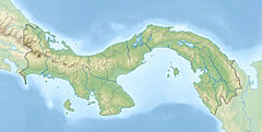
The Chepo River is a river of Panama in the Chepo District of Panama Province. It drains into the Pacific Ocean.
| Chepo River | |
|---|---|
 | |
| Location | |
| Country | Panama |
| Physical characteristics | |
| Mouth | |
• coordinates | 8°59′53″N 79°06′49″W |
Course
The uppermost reaches of the Chepo is alternately called the Bayano River after the construction of the Bayano Dam that resulted in the 350-square-kilometre (140 sq mi) lake reservoir.[1] The headwaters of the Chepo encompass watercourses running south from the San Blas Mountains near the Caribbean along with other rivers draining parts of the Majé and Darien Mountains.[2]
The Mamoni River is a major tributary farther down stream.
Measuring 206 kilometres (128 mi) in length, the Chepo-Bayano is the third longest river of Panama.[3]
Coquira, in the lower reaches, is the main riverine port.
See also
References
- Panama Fishing and Catching
- "In the rivers of Darien". Archived from the original on 2016-07-04. Retrieved 2012-04-17.
- Bayano River Archived December 18, 2010, at the Wayback Machine
- Rand McNally, The New International Atlas, 1993.
- CIA map, 1995.
На других языках
[de] Río Chepo
Der Río Chepo ist ein Fluss in Panama in der Provinz Panamá, der in den Pazifischen Ozean mündet.- [en] Chepo River
[es] Río Bayano
El río Bayano (también río Chepo) es un río que se ubica al este de Panamá, específicamente en el distrito de Chepo y la comarca indígena de Madugandí. Tiene una longitud de unos 206 km,[1] naciendo en la cordillera de San Blas y desembocando en el golfo de Panamá, siendo el tercer río más largo del país (siendo superado por el Chucunaque y Tuira).[2] Sus principales afluentes son el Mamoní, Ipetí, Chararé y Majé.Текст в блоке "Читать" взят с сайта "Википедия" и доступен по лицензии Creative Commons Attribution-ShareAlike; в отдельных случаях могут действовать дополнительные условия.
Другой контент может иметь иную лицензию. Перед использованием материалов сайта WikiSort.org внимательно изучите правила лицензирования конкретных элементов наполнения сайта.
Другой контент может иметь иную лицензию. Перед использованием материалов сайта WikiSort.org внимательно изучите правила лицензирования конкретных элементов наполнения сайта.
2019-2025
WikiSort.org - проект по пересортировке и дополнению контента Википедии
WikiSort.org - проект по пересортировке и дополнению контента Википедии
